Saturday, May 31, 2008

Salt Mines

no riding
(Krakow, Poland)


Highlights: visiting the 700-year old Wieliczka salt mine, getting acquainted with old town Krakow


Underground tour route (Wieliczka)


Carved out of rock salt (Wieliczka)


Underground chapel (Wieliczka)


19th Century VIP tour carriages (Wieliczka)

Journal: The first of two days away from the bicycle was mostly spent visiting the famous Wieliczka salt mine, declared by UNESCO in 1978 as one of the 12 most priceless monuments in the world. The mine first went into operation in the Middle Ages about 700 years ago (continuing until just recently, in 1996) and contains nine levels (going more than 1000 feet deep), 250 km of corridors and more than 20 chapels (the biggest of which took three artist-miners 70 years to finish). In places the mine resembles a vast underground city as loads of visitors (a million a year) come to see the rock carvings, chapels and displays. While many of the exhibits were created beginning about 80 years ago, tourists have been visiting the mine for well over 200 years (dating back to 1774). The complete guided tour nowadays begins with a 380-step descent into the first (highest) of three levels and eventually continues for nearly 5 km on foot, so it was a pretty good way to stay in shape when not bicycling. At the end I was even ready to climb the stairs back to the surface, but the only way up is in a rickety six-person elevator. The only fault with the three-hour tour was the high price (over $30 US plus $5 more to take pictures), a sign (I suppose) that Poland is doing well economically as a relatively new member of the European Union.

Friday, May 30, 2008

Vienna to Krakow in 12 Days

51 miles, 8.6 mph, 2010' elevation gain
(Oswiecim, Poland to Krakow)


View 2008-05-30 Oswiecim, Poland to Krakow in a larger map

Highlights: flat floodplains in morning, hot & hilly in afternoon, bizarre space station, wonderful forest trail, getting to Krakow


Yikes...never had to do this before! (Oswiecim)


How to ruin a perfectly good town square: insert hideous Communist structure directly in the middle (Oswiecim)


Typical morning scenery (east of Gromiec)


What the...?! Straight out of a 1970's sci-fi show (west of Rudno)


Pleasant afternoon surprise (east of Rudno)

Journal: The aim today was to get close to Krakow and then take several days off to enjoy the city. The morning was essentially flat as we pedaled along the wide floodplains of the River Wisla. The only problem occurred when we followed signs for the "river trail" (instead of the Vienna-Krakow Greenway) and ended up on a messy stretch of worn-out & overgrown concrete that appeared not to have been maintained since World War II. After re-emerging onto the proper trail, we shortly crossed the river via a narrow causeway that involved climbing half a dozen steps with our bikes. Once on the left bank we meandered thru farm country until the heat of the day came upon us, so we decided to stop for a lunch break and consume some traditional Polish food (sour rye soup with egg & mushrooms, and potato pancakes with vegetables for me). The afternoon consisted of a few good climbs in the hot sun before finally cresting and beginning an enjoyable 10-mile stretch (shaded forest bike paths, then downhill out of the hills once more) to the outskirts of Krakow. As has become typical in eastern Europe, the supposed campground we were looking for did not exist and we had to continue riding towards the city proper. No harm in the end as we found a reasonably priced hotel room ($60 US per night for a double room) that we will use as a base to explore Krakow over the next several days.

Thursday, May 29, 2008

Death Camp

21 miles, 8.7 mph, 480' elevation gain
(Pszczyna, Poland to Oswiecim)


View 2008-05-29 Pszczyna, Poland to Oswiecim in a larger map

Highlights: easy morning ride with headwinds, visiting Auschwitz-Birkenau concentration camp in the afternoon


One-of-a-kind curvy house (Wola)


One of many cinder block homes (Wola)


Around the bend...first view of Auschwitz camp II (Oswiecim)


"Work Sets You Free"...entrance to Auschwitz camp I (Oswiecim)


Firing squad wall at camp I (Oswiecim)


No way out (Oswiecim)


All that remains (Oswiecim)


Where 500 prisoners "lived"...originally designed for 52 horses (Oswiecim)


Well-known entrance to Auschwitz camp II (Oswiecim)

Journal: Today's ride was simple enough as we only rode 15 miles from the medieval-era center in Pszczyna to the former Nazi concentration camp at Auschwitz. After finding a set of maps to get us all the way to Krakow, there were no hills to slow us down today. However, the headwinds & rough riding surface at times were frustrating as I wanted to reach Auschwitz as quickly as possible in order to spend as much of the rest of the day visiting the museum & memorial. Then suddenly, out of nowhere, as we rounded a small bend in the innocuous rural countryside, we were there...standing at the edge of the notorious Auschwitz II concentration camp that housed more than 90,000 prisoners at once in 1944.

We had just a few minutes to spare before starting a four-hour guided tour (in English) in the afternoon. It was well worth the price (about $19 US) as we visited many of the buildings on the site of the smaller first camp (Auschwitz I), then took a bus over to the much larger second camp (Auschwitz II) several miles away. The tour itself was extremely helpful & tastefully done, but quite sobering nonetheless. The pictures I have seen before did not prepare me for the immense size of the second camp, which was built primarily to house & kill as many prisoners (mostly Jews) as possible. In total, more than one million people were deported to Auschwitz by the Nazis from 1942-1944; only 7000 survived to be liberated by the Soviets in January 1945. Nowadays, more than one million people annually visit the museum (which includes both camps) to see what is chronicled here. Exhibition signs are written in three languages (Polish, English & Hebrew) but guide books are available in many others. And while it was very crowded at times today (including a lot of school tour groups), I take it as a good sign that so many people are visiting here and choosing to remember rather than forget the past.

Wednesday, May 28, 2008

One Last Big Climb

56 miles, 8.3 mph, 2350' elevation gain
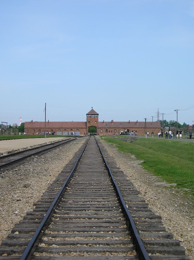
(Jablunkov, Czech Republic to Pszczyna, Poland)


View 2008-05-28 Jablunkov, Czech Republic to Pszczyna, Poland in a larger map

Highlights: reaching Poland, last big climb before lowlands, friendly Poles, roasted pig for lunch, staying away from traffic, lots of lakes, only 25 km from Auschwitz


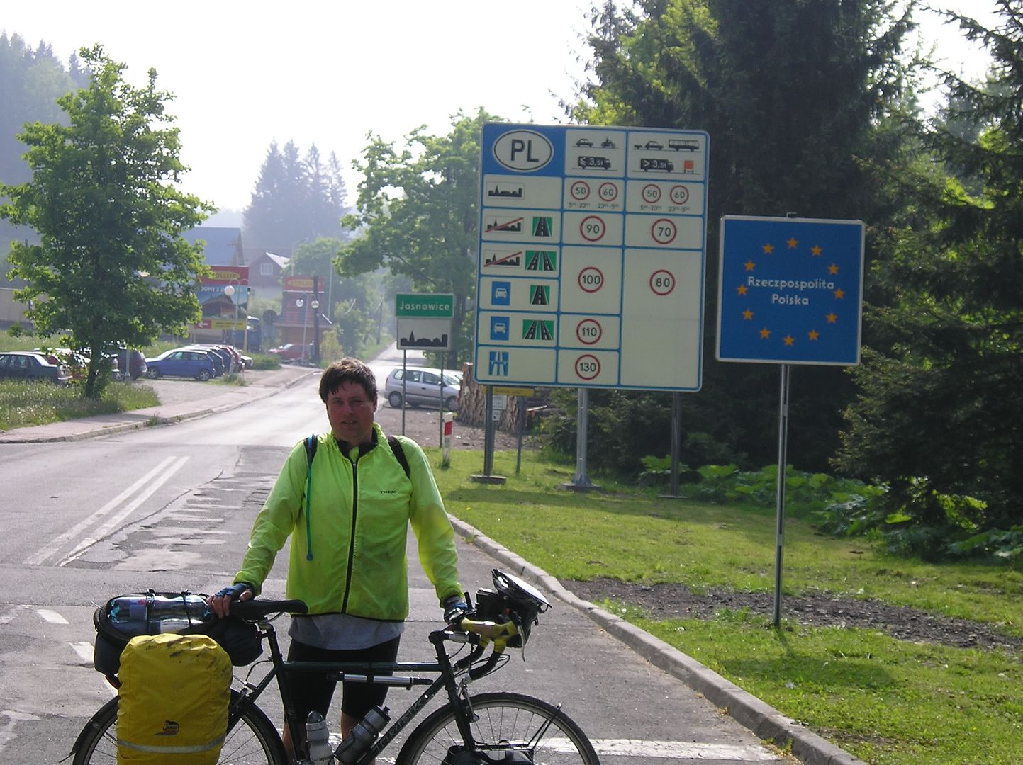
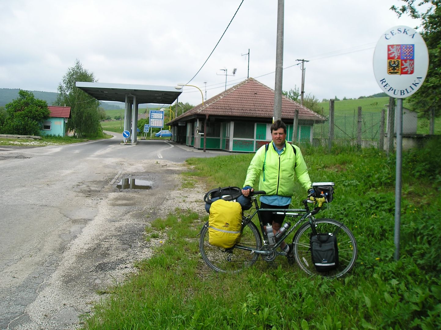
Another country! (at the Polish border, southwest of Istebna)


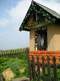
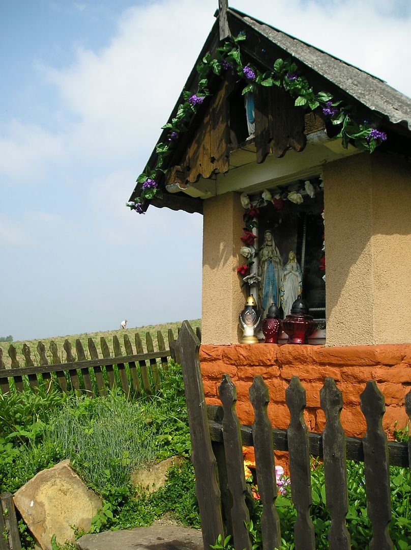
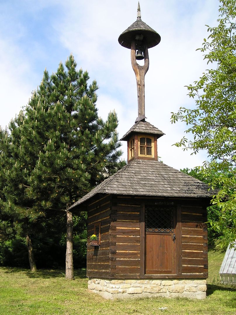
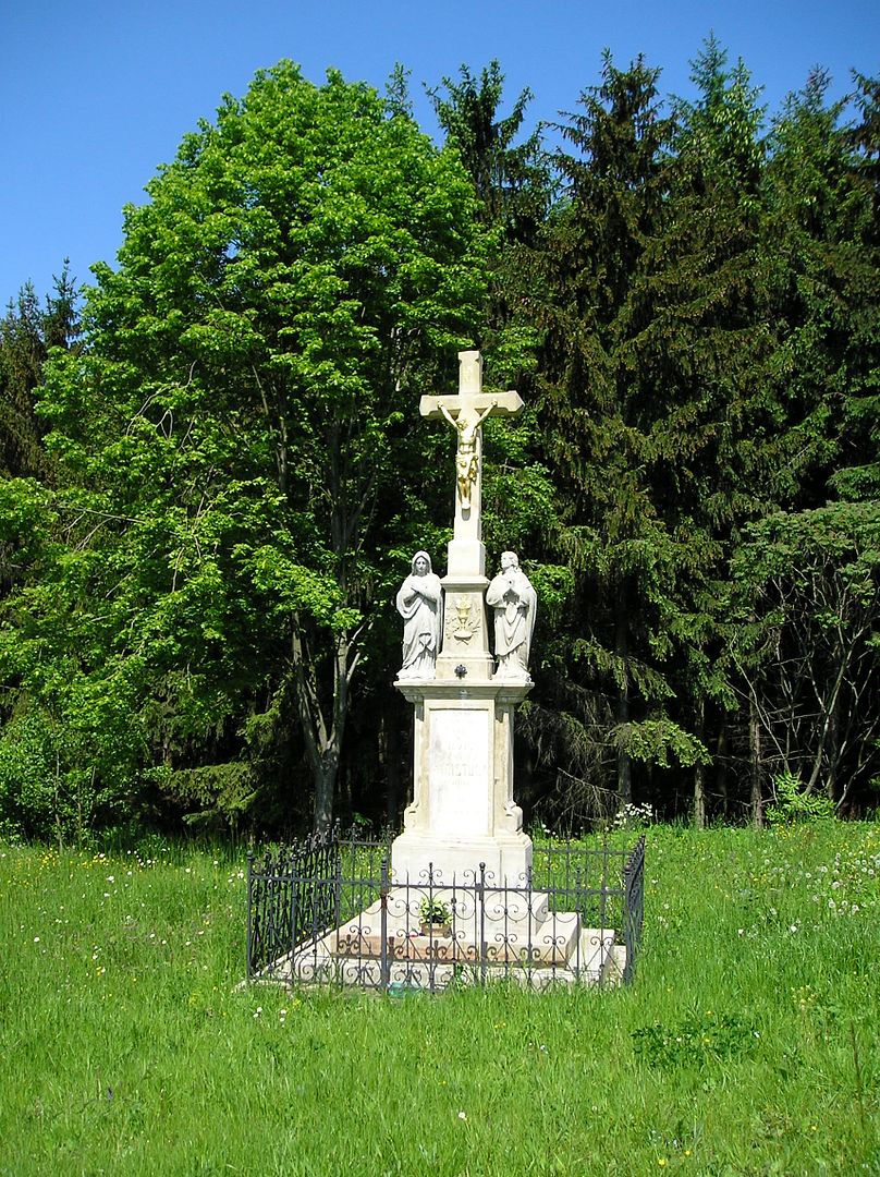
A roadside shrine - quite common in rural eastern Europe (west of Istebna)


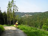
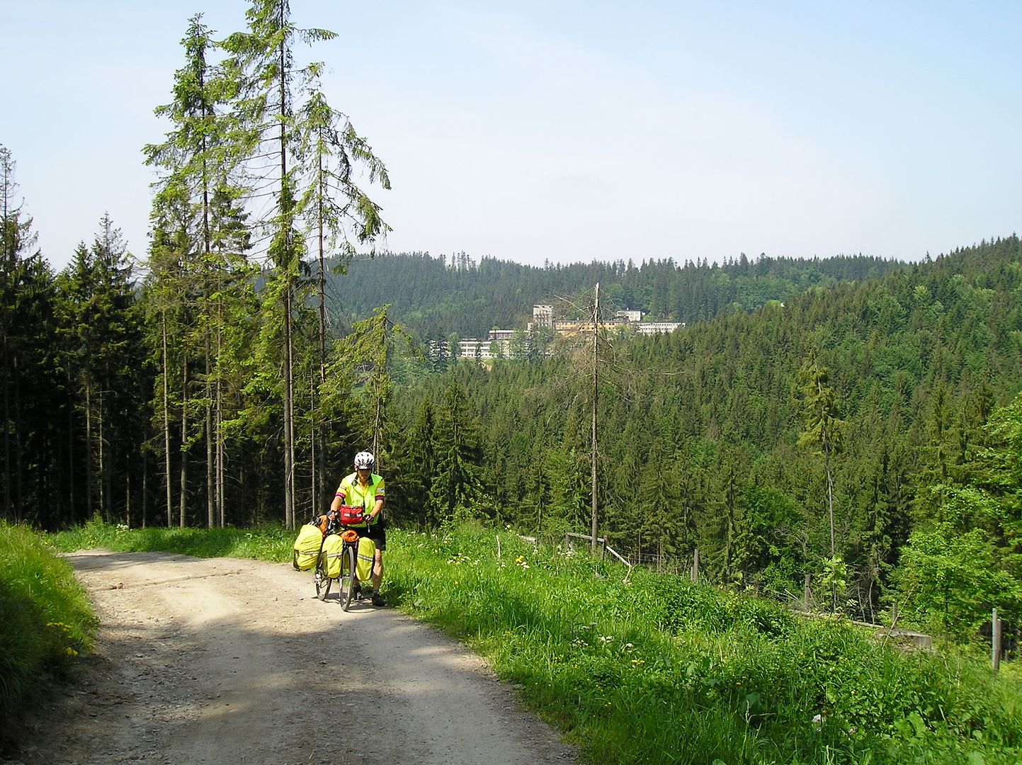
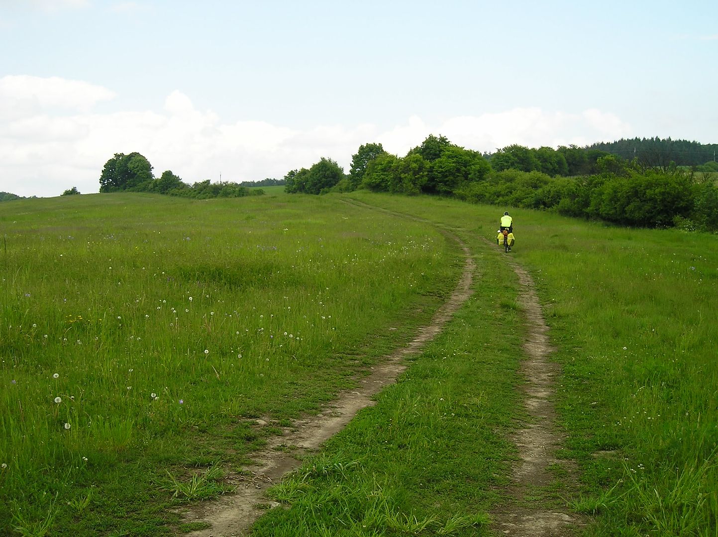
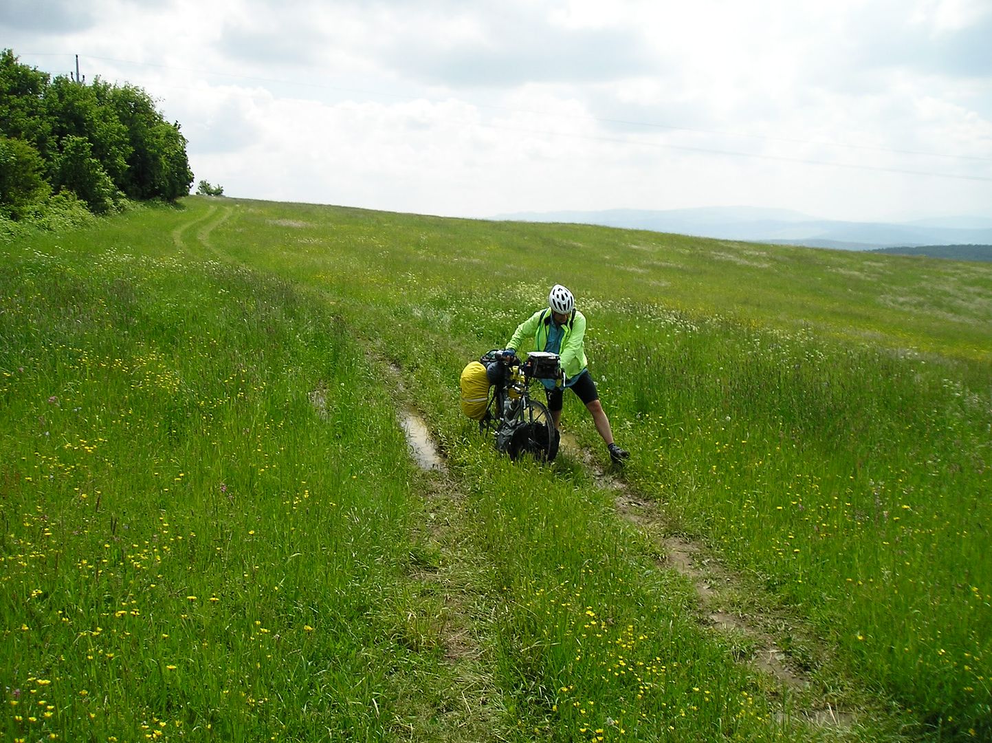
Near the top...too steep to pedal (southeast of Wisla)


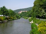
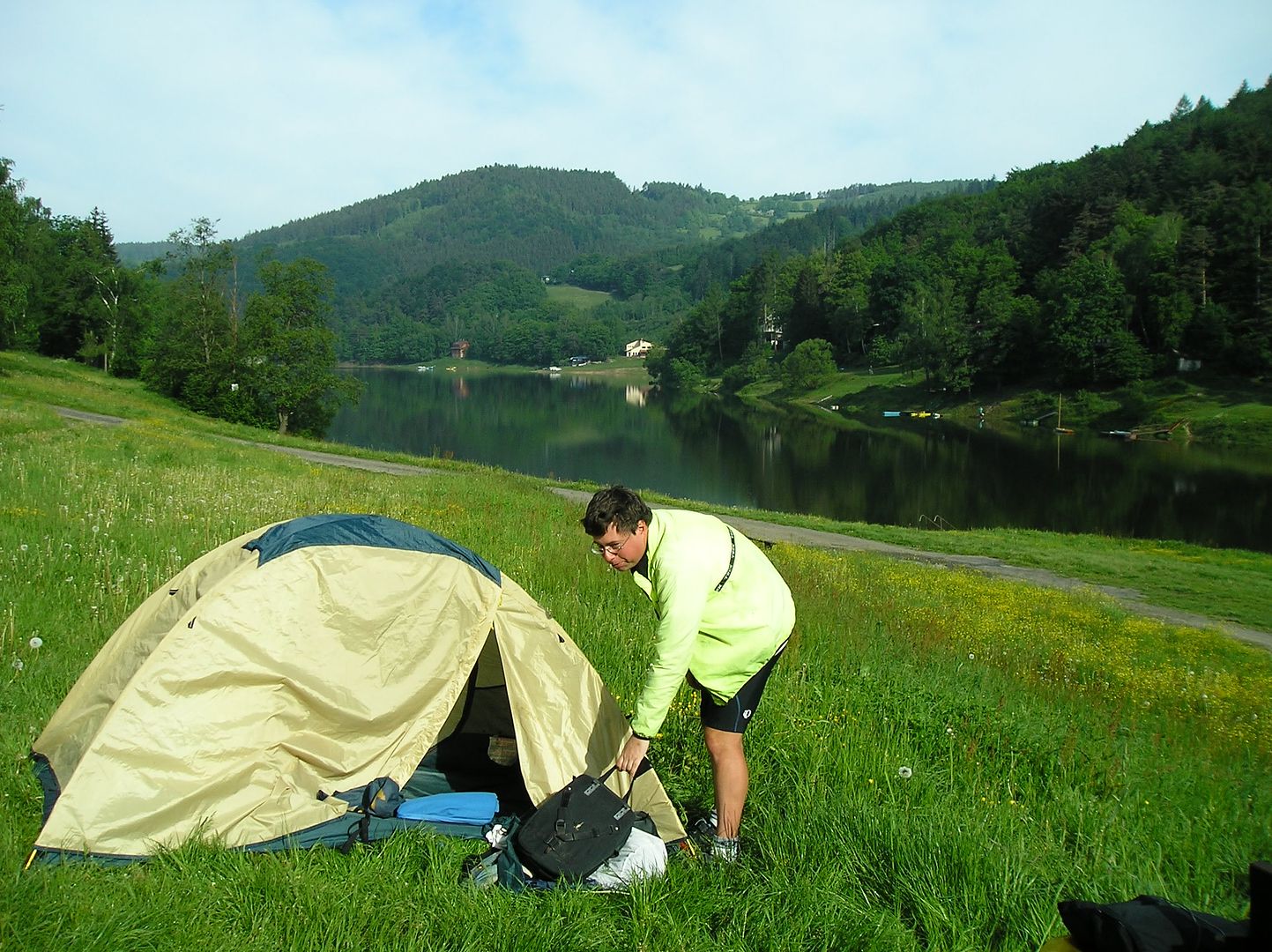
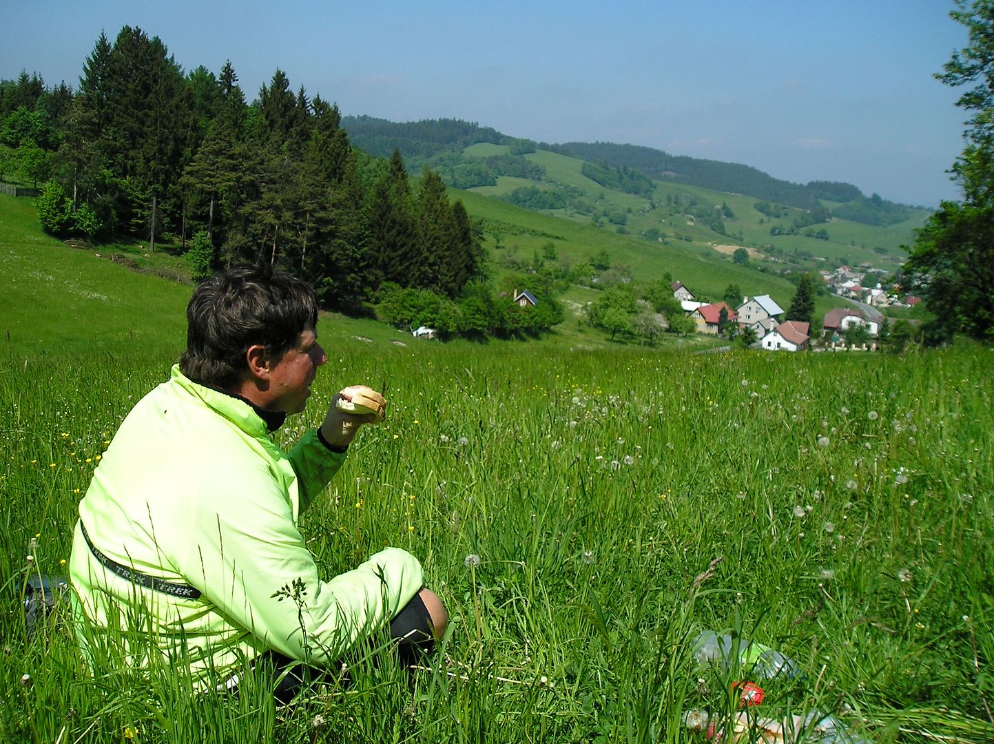
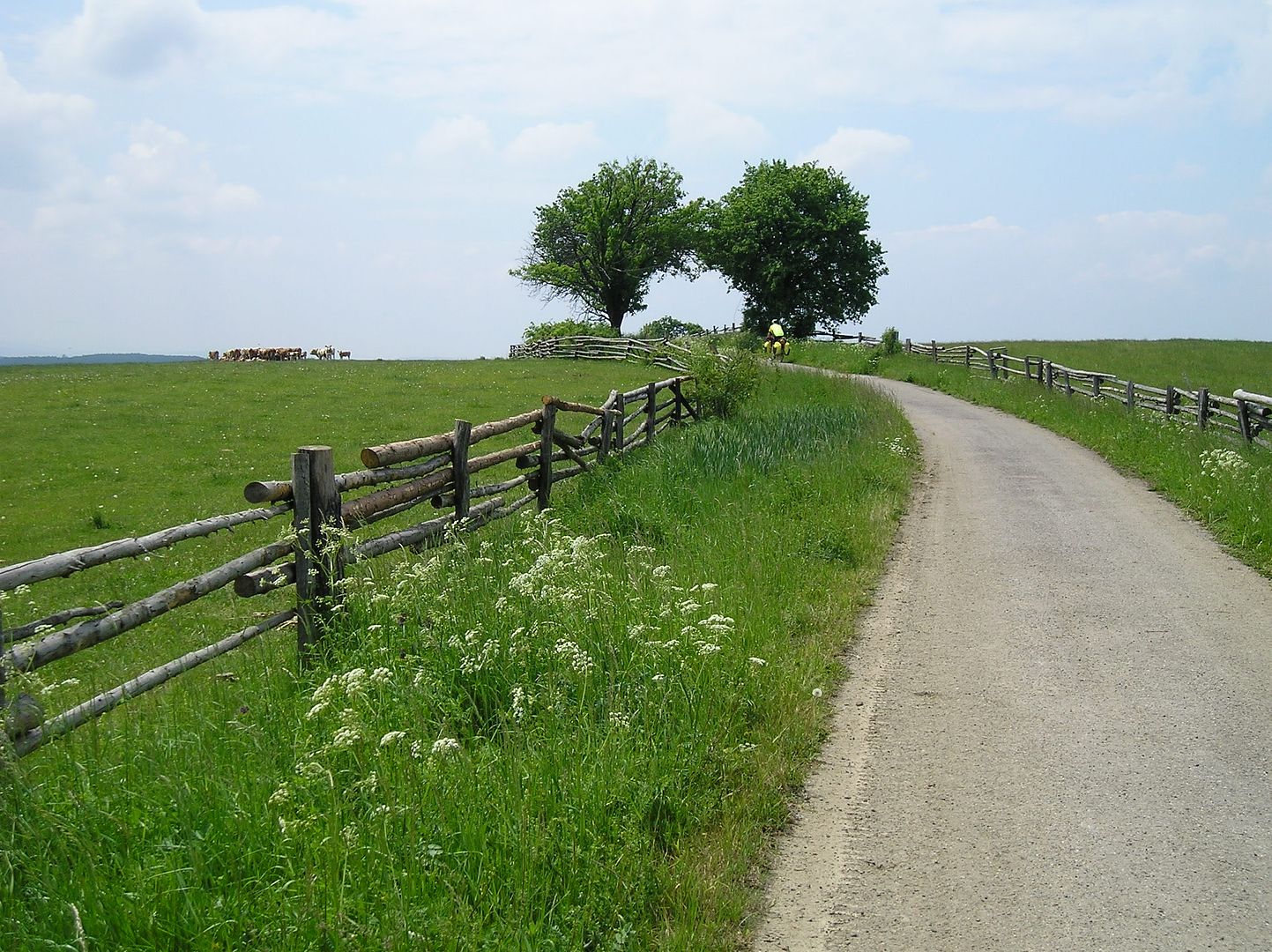
Great lunch spot, and all downstream from here! (Wisla)


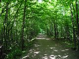
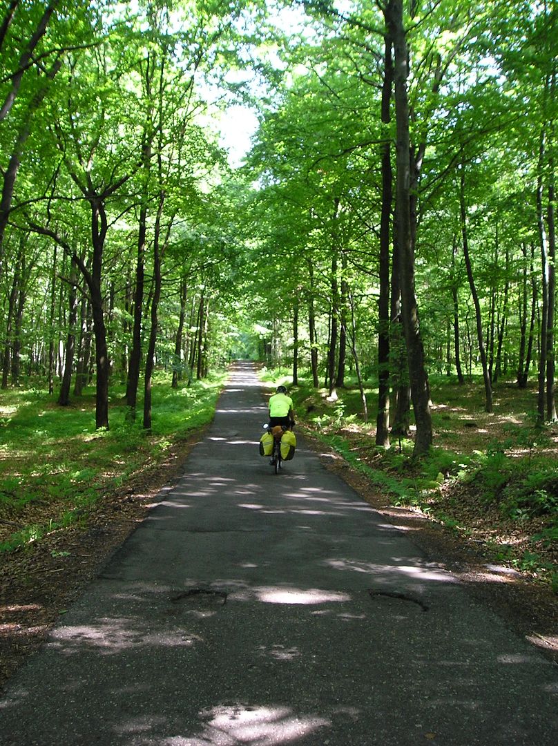
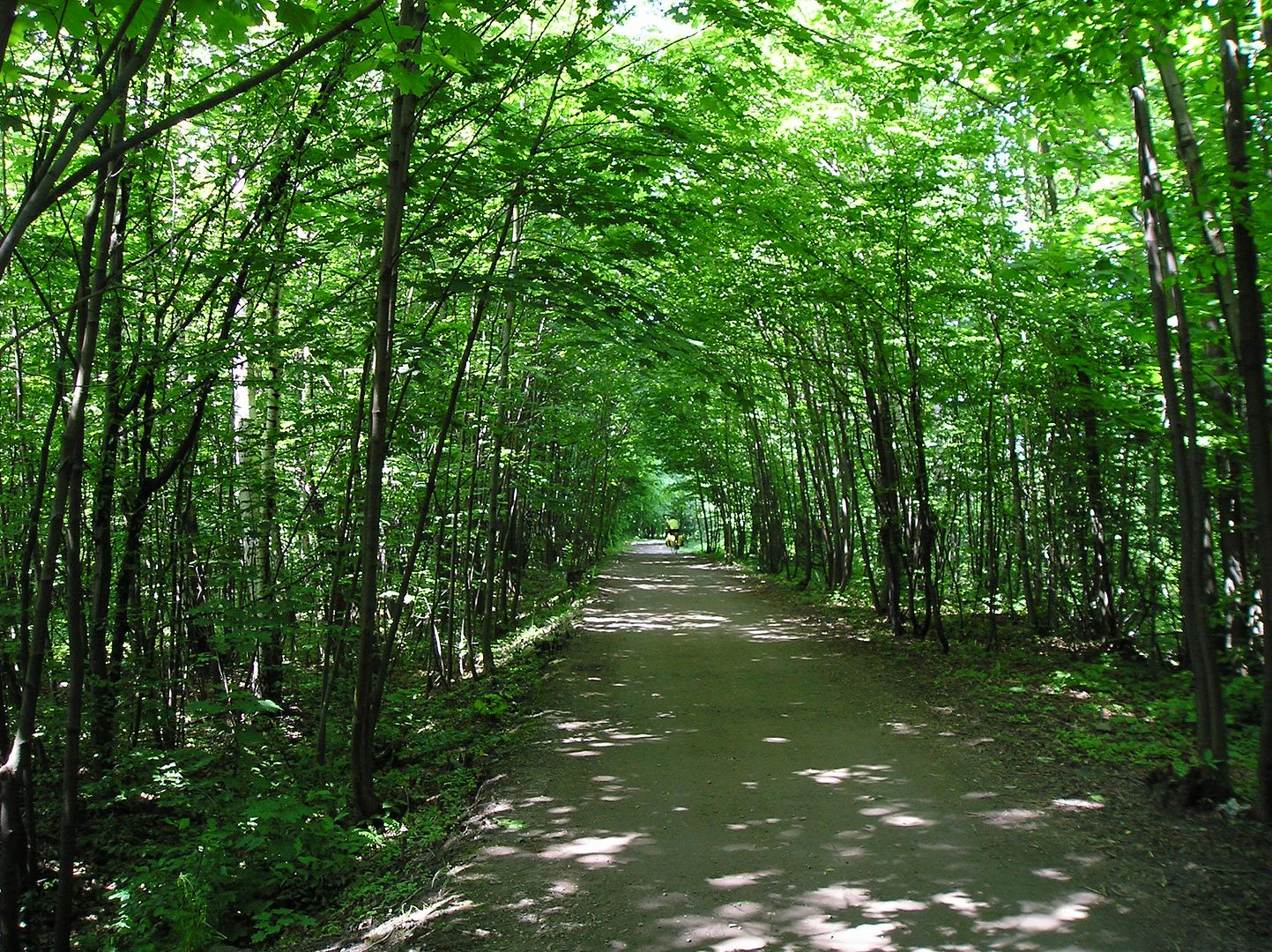
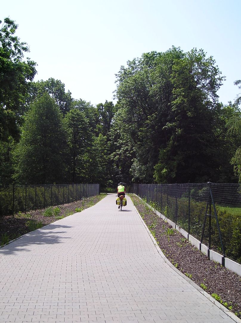
Surprisingly nice Polish bike path (near Ustron)


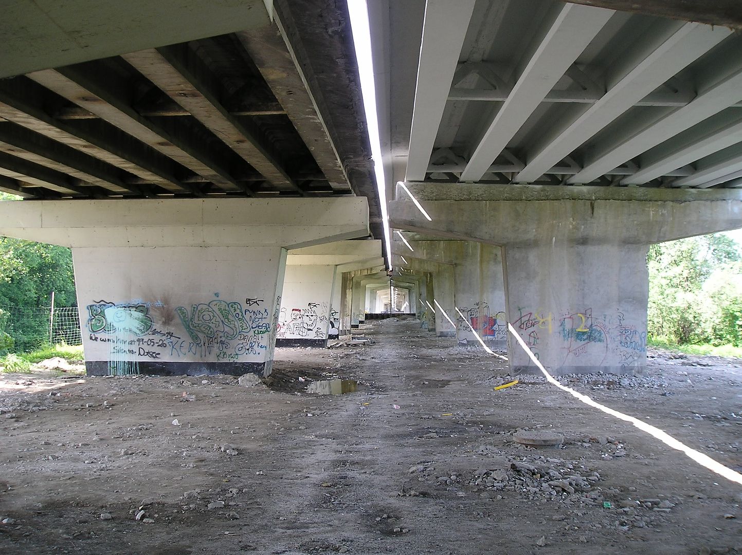
Not so nice anymore :( (near Skoczow)


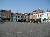
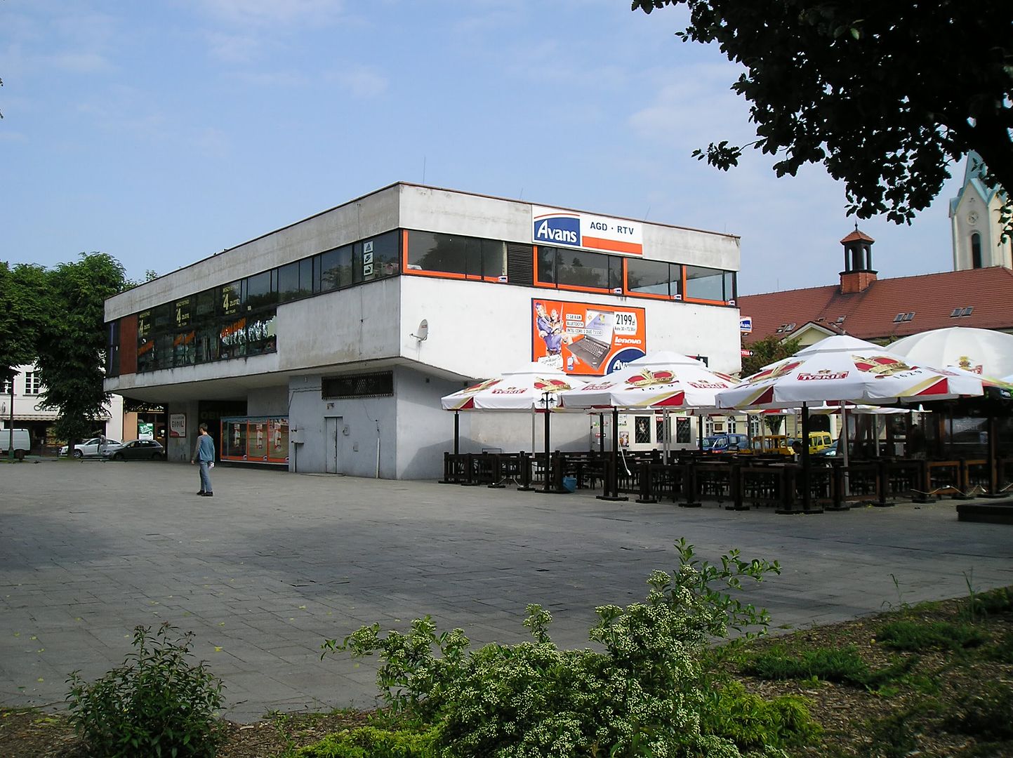
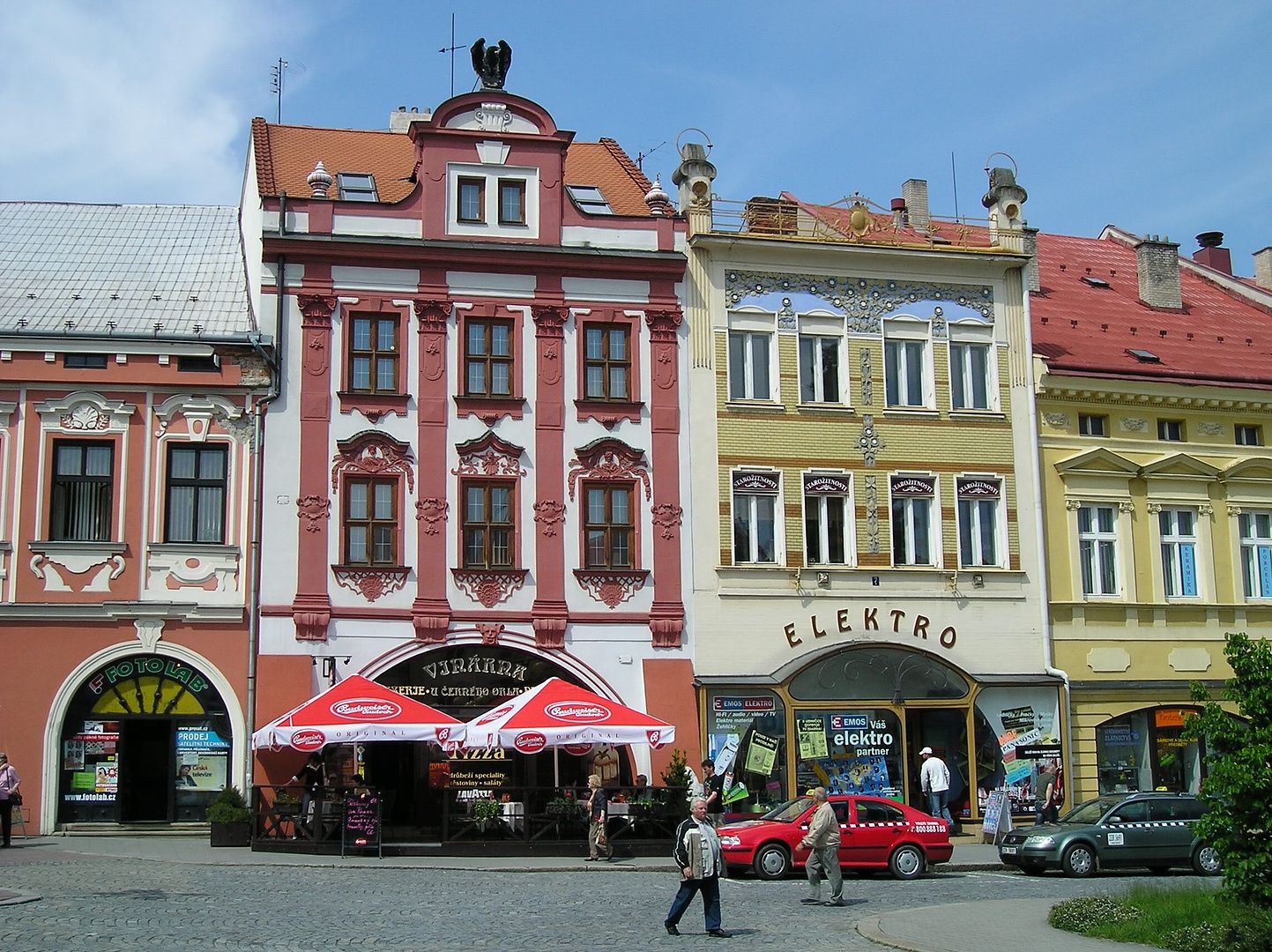
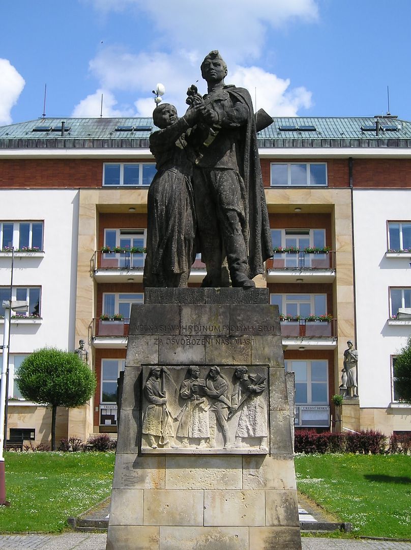
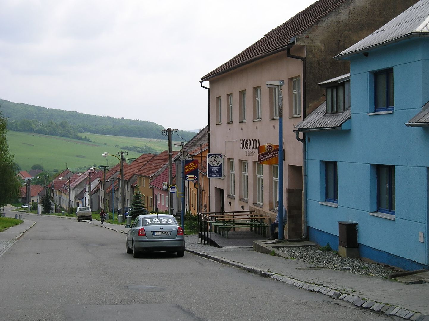
Old-fashioned Polish town square (Skoczow)


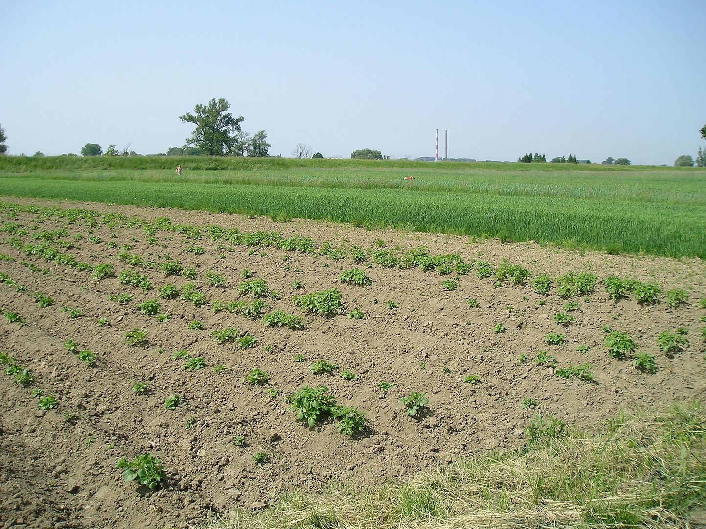
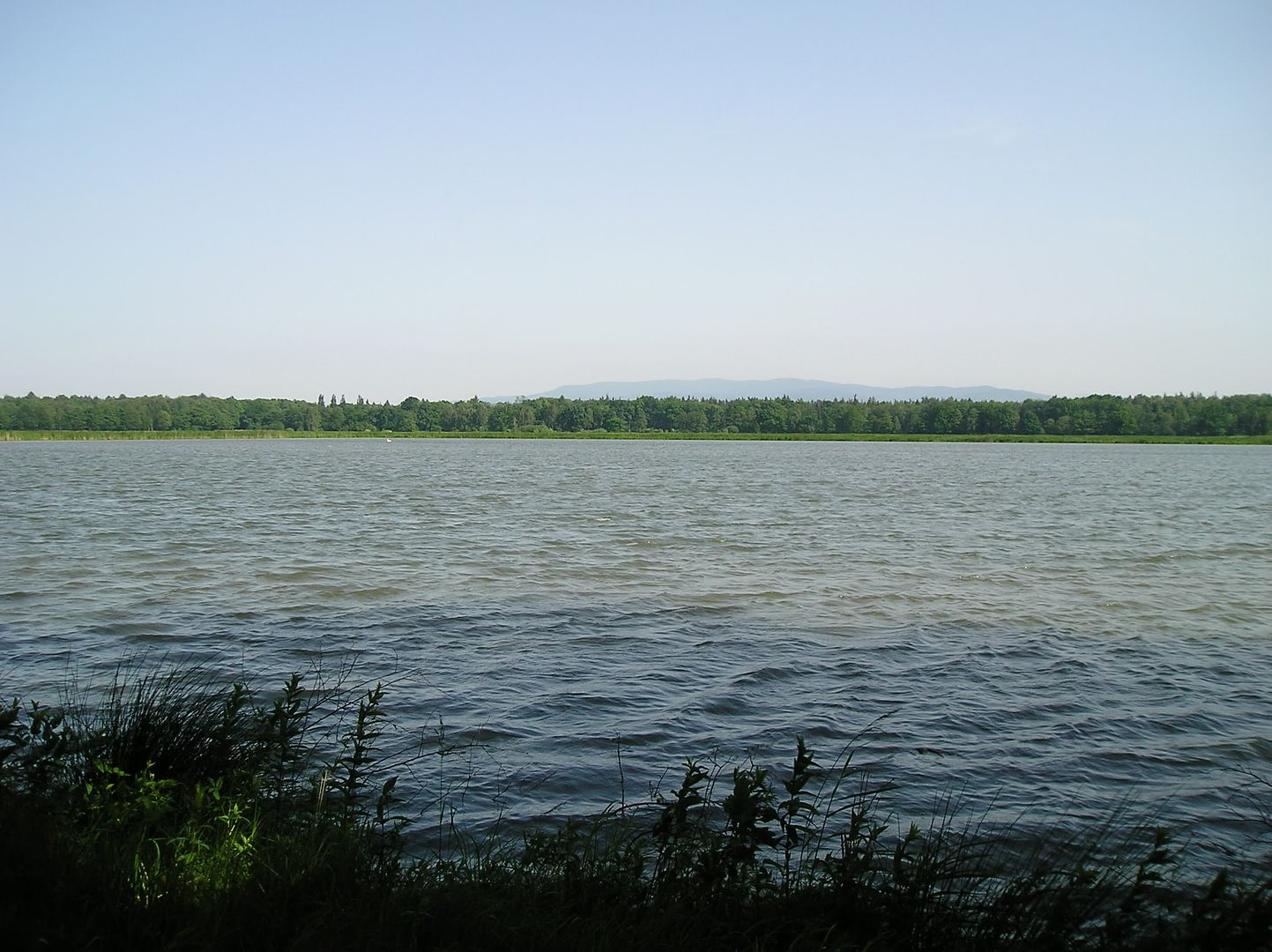
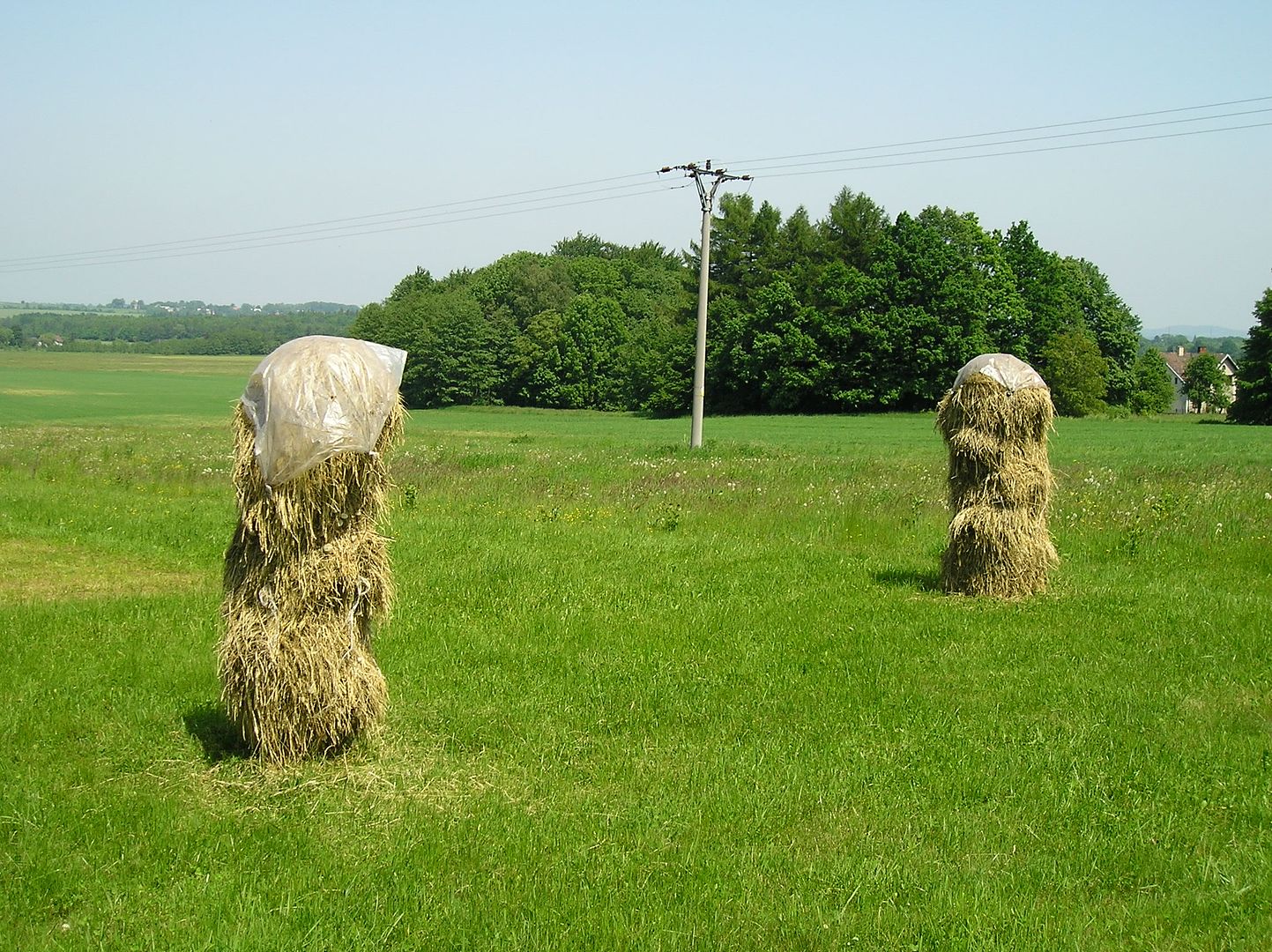
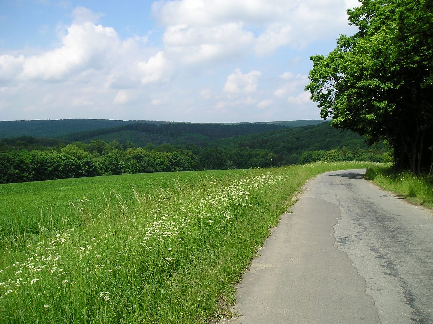
Flat...almost as far as the eye can see! (near Zaborze)
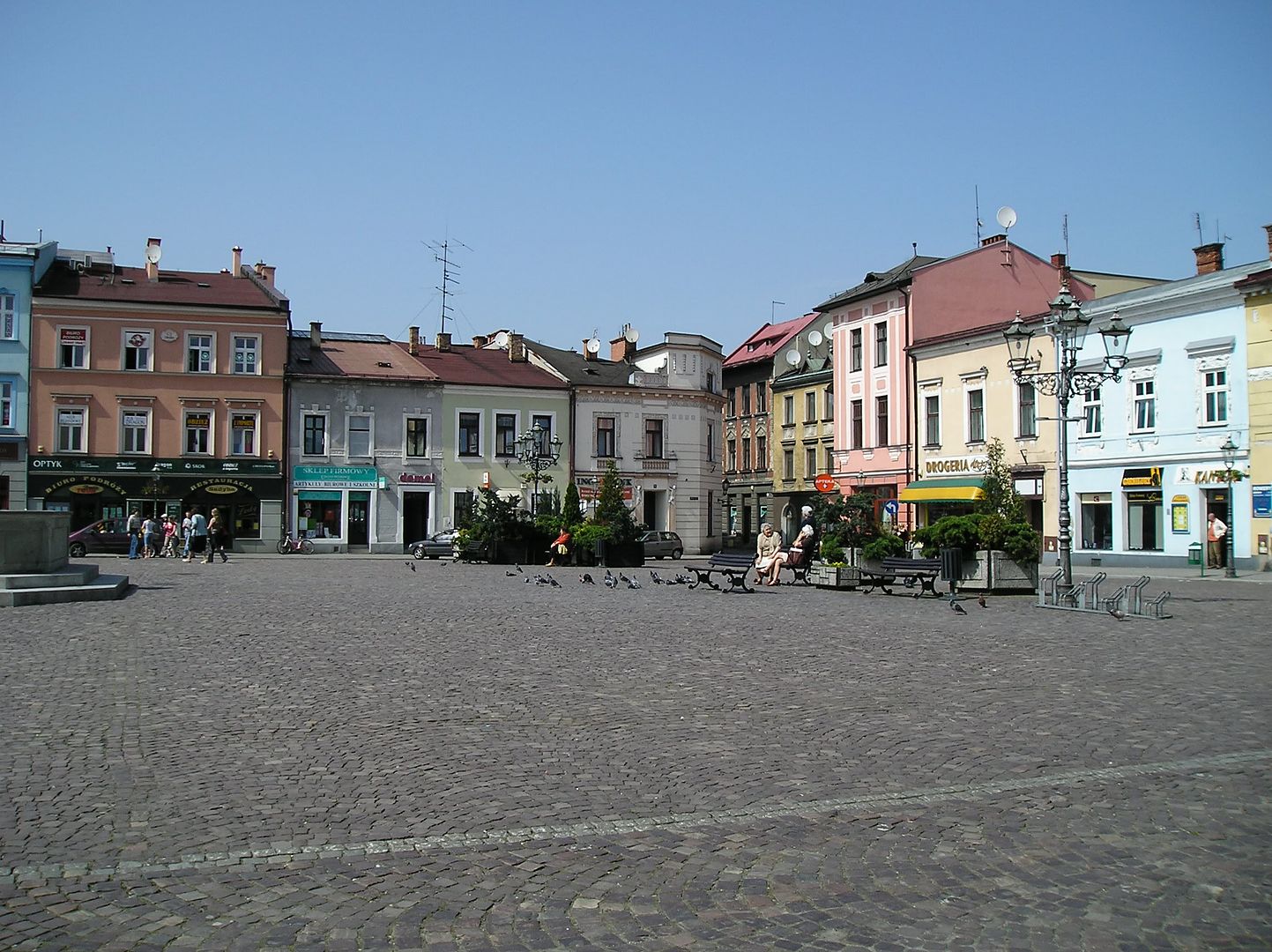
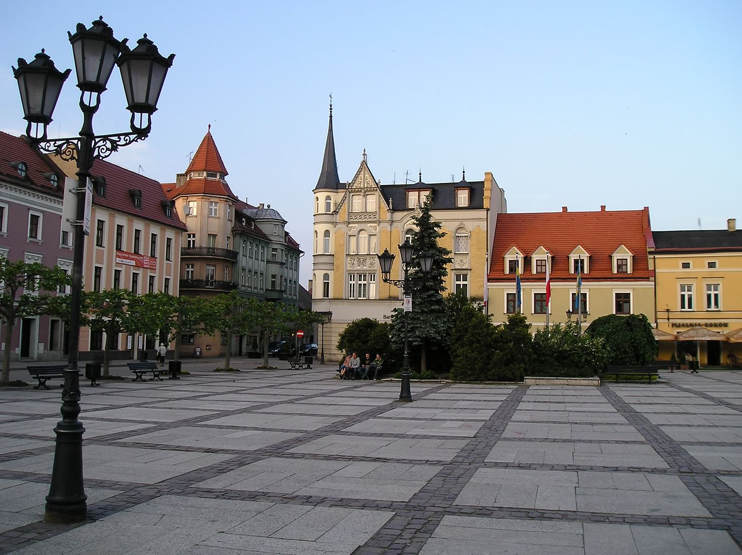
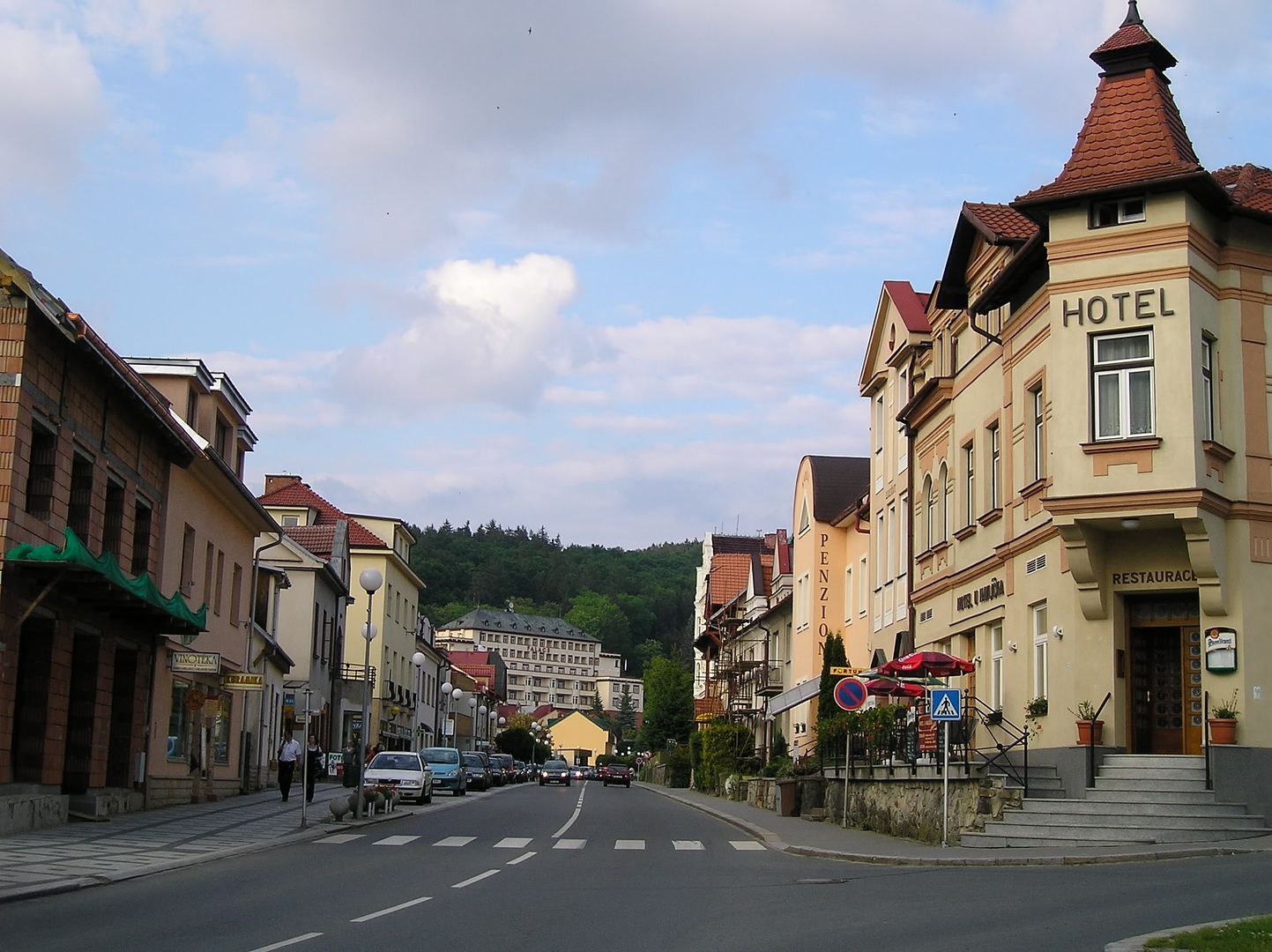

Pszczyna's beautiful central square

Journal: Today was the seventh straight day of climbing at least 2000 feet, and also the last, as we have finally reached the flatlands in southern Poland. The day began with a short 7 km ride from Jablunkov (elevation 1260') up to the Polish border (complete with a 12% incline). From there the riding got steeper & tougher for much of the rest of the morning. Fortunately, temperatures were a good 5 to 10 degrees cooler than yesterday (& less humid too) and we were doing much of the climbing on well-shaded forest roads. When we reached the village of Istebna (elevation 1960') it appeared we would have to ride 2-3 miles uphill on a busy steep road with no shoulder & lots of scary-looking trucks. Then, with the aid of my handy GPS unit, I confirmed a better parallel route. The alternate may have taken us longer (less direct & quite steep in places with a rough unpaved surface) but it also kept the stress levels low without the big trucks. By the time we reached the summit (elevation 2630') just before noon we had already climbed 1800+ feet (in only 12 miles), but at least the rest of the day would be downhill or flat.

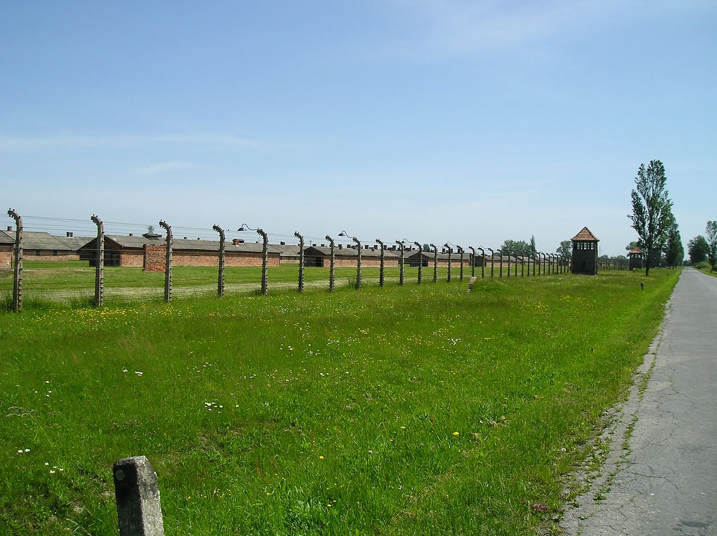
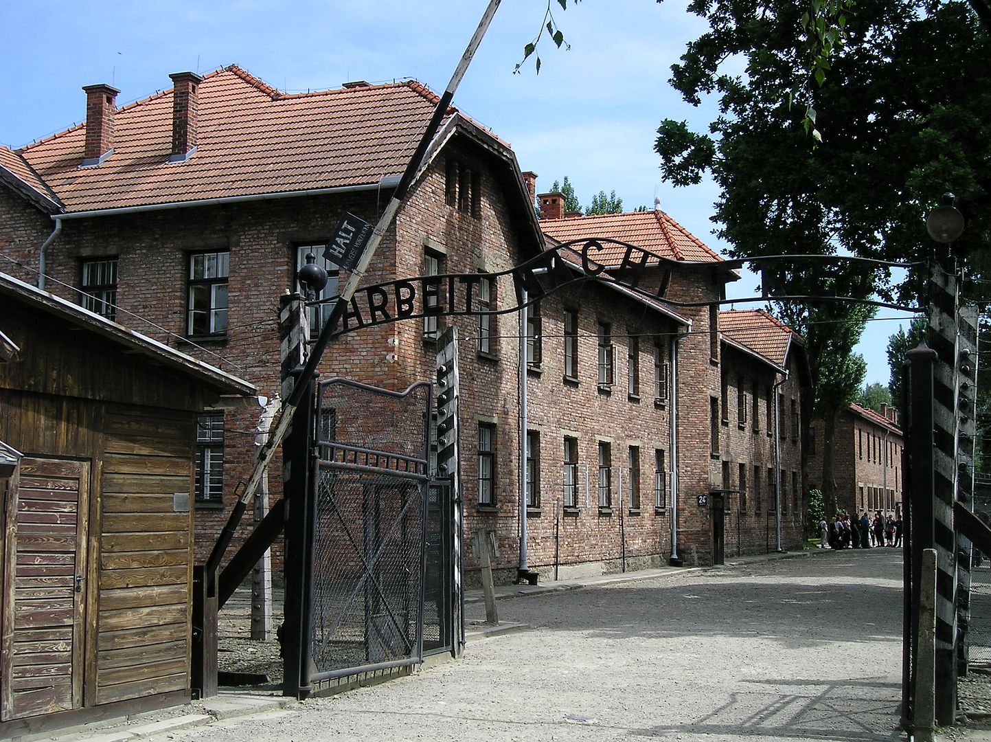
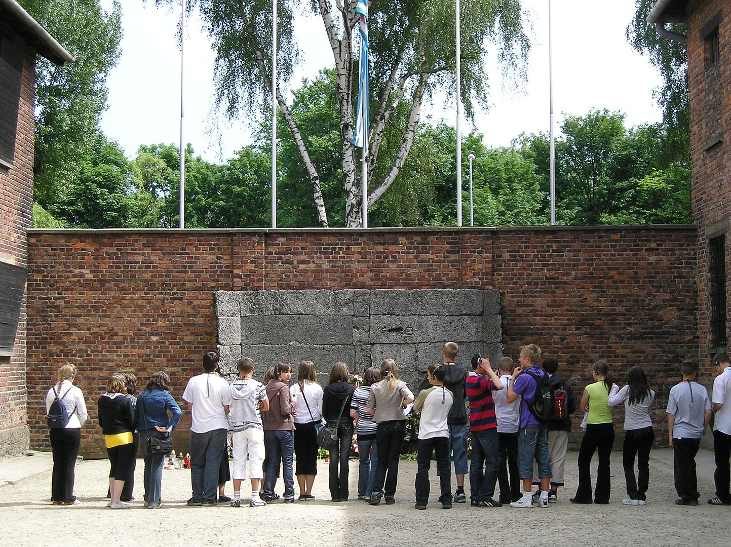
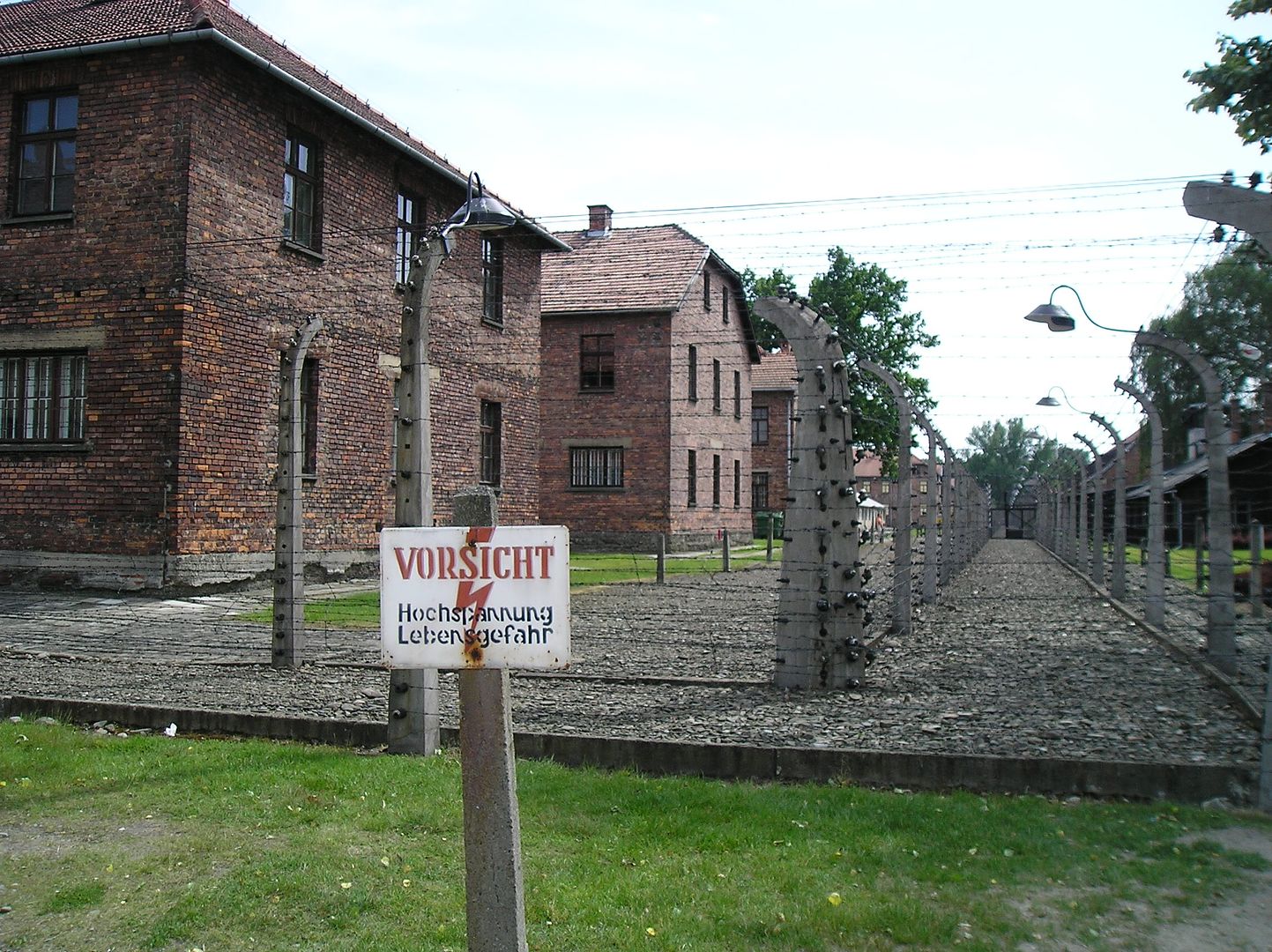
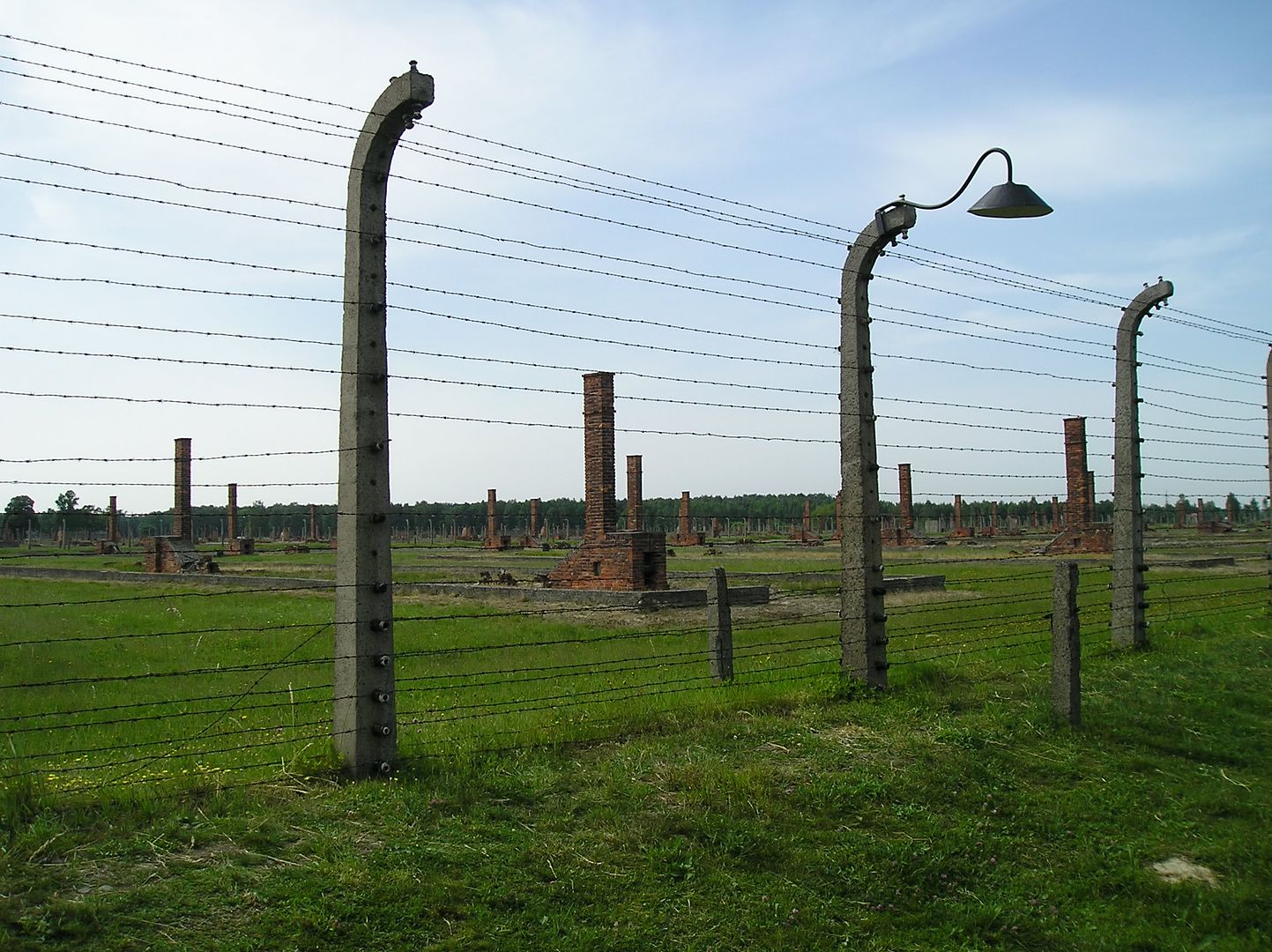
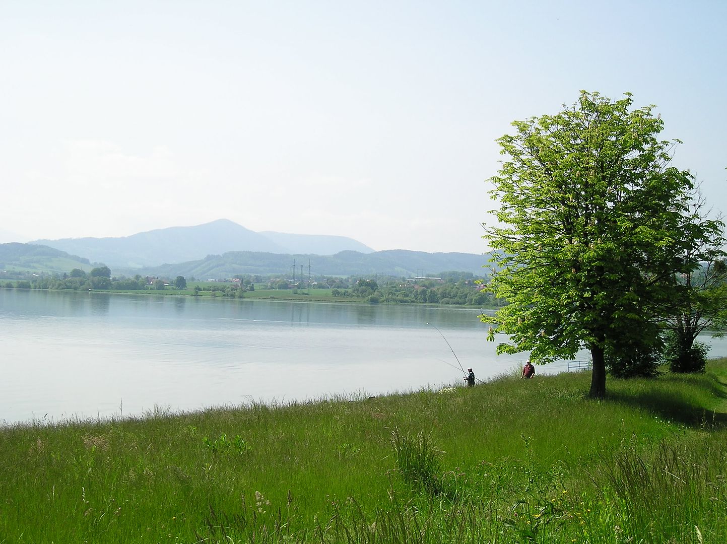
The rest of the day was quite pleasant indeed. Shortly after cresting, we passed by the Polish Presidential summer house at Zameczek before coasting down to the bustling resort town of Wesla (where I enjoyed a roasted pig lunch). From there, it was mostly a mix of bicycle trails (paved & unpaved) along the river and quiet country roads. We stopped in the town square at Skoczow to look for more maps (not much luck) then continued into the flat countryside (with lots of lakes) before ending the day in the scenic historic town square at Pszczyna ("Pearl of the Upper Silesia", pronounced 'push-nah'). Tomorrow will be a short day as we ride only 25 km to the town of Auschwitz, then spend the afternoon visiting the site of the former concentration camp.

Initial impressions of Poland have been quite good. The rural mountain areas near the Czech border appeared to be somewhat poor (with people working in the fields by hand), but everywhere else seemed no different from the Czech Republic. People have been very friendly & helpful too, even when they speak no English. It surprises me at times how easy it is to understand each other (usually when asking for directions) even when we do not speak the same language. As far as roads go, it has been hit & miss (some are well paved, while others have been quite bumpy). However the drivers continue to give us plenty of space when passing, and we continue to have luck in avoiding most of the dangerous truck traffic.

Tuesday, May 27, 2008

Gluttons For Punishment

34 miles, 7.7 mph, 2480' elevation gain
(Frydek-Mistek, Czech Republic to Jablunkov)


View 2008-05-27 Frydek-Mistek to Jablunkov, Czech Republic.kmz in a larger map

Highlights: big breakfast, super-wide bike path (for 1/10th of a mile), warm day, much hillier than expected in afternoon, forest riding, only 7 km from Poland


Morning view from outside the hotel (Frydek-Mistek)


Widest shortest bike path ever (Frydek-Mistek)


Czech hay bales (near Smilovice)


Talk about "going green"! (near Podgrun)

Journal: Today could have been a relatively easy day as we headed across the lowlands of northeastern Czech Republic into Poland. Instead, I convinced myself & Joe to take the more interesting way along the official Vienna-Krakow route to the southeast. Even so, I did not expect today to be as hilly as it was. We were only supposed to ride 50 km or so thru the last valley in the Czech Republic, with no net change in elevation. However, the path we took ran along the hillsides of the valley and had quite a few ups & downs (but nothing too lengthy). I'm sure the heat & humidity of the day contributed to my frustration at times as we slowly counted down the miles to our target destination for the day (the town of Jablunkov), a mere 7 km from the Polish border.

Similar to each previous day in the Czech Republic, the scenery was quite pleasant and the route relatively traffic-free. The most interesting parts of the day were an extremely short & unnecessarily wide bicycle path (only 1/10th of a mile long!), the Czech version of odd-looking hay bales (very different from their Slovak counterparts, but unusual nonetheless), a shady ride on a bumpy forest road, and the city square in the town of Jablunkov (which has a major highway running thru the middle of it). Slovakia is less than 10 miles to the south and heavy truck traffic consistently whizzes thru the center of town, nearly ruining what would otherwise be a very nice place. Fortunately, a bypass is finally being constructed around town (something that probably should have been done 30 or 40 years ago).

Monday, May 26, 2008

Finally Out Of The Big Hills...Still Lots Of Small Ones

48 miles, 8.6 mph, 2630' elevation gain
(Lake Bystricka, Czech Republic to Frydek-Mistek)


View 2008-05-26 Lake Bystricka to Frydek-Mistek, Czech Republic in a larger map

Highlights: leaving the mountains, finding the Vienna-Krakow Greenway, gentle rolling hills in the morning, slow going (hilly & hot) in the afternoon, four-star hotel


Pretty nice free camping spot (Lake Bystricka)


Small town ceremonial gathering place (Jarcova)


This can't be the bike trail, but it is (south of Policna)


Another town, another nice town square (Valasske Mezirici)


No town too small for great Czech bicycle information (Stary Jicin)

Journal: We finally left the big hills behind today after four grueling days of climbing up & over the White Carpathian Mountains. That was the good news; the bad news was the constant rolling terrain that took its toll by the end of the day. The morning riding was nice enough as we coasted from the lake (where we camped last night for free) to the river (which flowed downstream away from the mountains). When we reached the city of Valasske Mezirici we bought another map (that will get us into Poland) and replenished our food & water supply. From there, the rest of the day was spent mostly on small rolling hills (with 50 to 200 foot ups & downs). Since we were riding on flatter slopes & since we usually had a breeze to accompany us, we didn't fully factor in the cumulative effect of the smaller hills along with the warmer temperatures (mid 70's). By the end of the day, we were tired and had gained another half-mile of vertical elevation gain for the fourth time in five days. When we reached our intended campground on the outskirts of Frydek-Mistek, it was closed (like most campgrounds in the Czech Republic appear to be). Our choices were to camp there anyways with the gypsies (who appear to be living there) or head next door for the comforts of a four-star hotel (which is what we ended up doing).

Joe spotted the first sign for the "Vienna-Krakow Greenway" bike route today, meaning we are definitely heading in the right direction. The path takes quite a few twists & turns in some spots, and we got separated from the path on several occasions, but for the most part the signage is quite good and the roads are pleasant. Fortunately I have my GPS with me, so it is not hard to navigate along relatively quiet back roads when we do get lost. We are now less than 30 km from the Polish border (as the crow flies) and may cross the border as early as tomorrow depending on the route we take. From there it may only be another day or two to Krakow (the eastern-most part of this year's ride).

Sunday, May 25, 2008

More Record-Setting Steepyness

39 miles, 7.5 mph, 3160' elevation gain
(Luhacovice, Czech Republic to Lake Bystricka)


View 2008-05-25 Luhacovice to Lake Bystricka, Czech Republic in a larger map

Highlights: steepest morning ever, flat river roads in the afternoon, eating two ice creams, almost out of the hills (I hope), more good weather


Roadside monument (near Loucka)


Impossibly steep road - had to walk down (near Desna)


Nice job with the flowers (Vsemina)


Perfect lunch spot (near Liptal)


Unusual crosswalk (Vsetin)


Not many of these East German relics left (near Przno)


1942 U.S. WWII jeep - still runs well (near Mikuluvka)

Journal: So far the Czechs have done a wonderful job marking their bicycle routes (the signage is better than Germany or Austria) & keeping the bicycles away from the cars. The downside has been some of the steepest climbs I have ever done on a touring bike. Today was no different as I have now climbed more than 2 vertical miles in the past 4 days yet traveled less than 160 miles horizontally. Began the day with an unexpected 450-foot climb over 5.8 miles, followed by a 550-foot difficult stretch in 1.4 miles (with a 12% grade). After reaching the top (2120' elevtion) we dropped down 1000 feet to the next valley in just 3 miles. I don't particularly enjoy steep descents like this since I am an aggressive braker (afraid of losing control going too fast downhill; the hard braking can be quite tiring) and also worry about my tires popping if there is too much heat friction on the rims from the braking (this has happened before to me).

After reaching the town of Vizovice around noon we weren't ready for lunch yet, so we decided to try our luck with some more hills. It wasn't bad at first, then became excruciating once again. As a matter of pride I try to ride up every hill I encounter, but I had to walk up a short stretch. After reaching the top (500' higher than Vizovice, just 3 miles away) we encountered the craziest downhill segment yet and had to walk our bikes down about 250 feet over 0.4 miles on a rocky unpaved road. After dropping down to about 1200' elevation, we were greeted with another unexpected climb (back up to 1770' elevation) before taking a break for lunch. By the time we stopped to eat a sandwich and enjoy the Alp-like view from the top of the ridge we had traveled less than 18 miles, yet climbed more than 2500 feet (and descended another 2000 feet) making this the steepest riding I have ever done.

The after-lunch ride was a stark contrast to that of the morning. We literally coasted all the way downhill to the city of Vsetin, then followed the river downstream from there in the direction of the flatter lands. We decided to do a short climb at the end of the day to reach the last campground on our maps, and thankfully the ride up there was not so bad. Tomorrow we expect to finally leave the big hills behind and start adding some more miles each day as we make our way to southern Poland.

Saturday, May 24, 2008

Short, Steep Day

25 miles, 7.0 mph, 2270' elevation gain
(Bojkovice, Czech Republic to Luhacovice)


View 2008-05-24 Bojkovice to Luhacovice, Czech Republic.kmz in a larger map

Highlights: several steep climbs, wildflowers & green hills, near-deserted country roads, good weather, riding across a farmer's field, early finish in resort town, breaking a tent pole


Nice views, quiet roads (north of Bojkovice)


Even quieter road...across a farmer's field! (north of Rudimov)


A bit muddy in spots (north of Rudimov)


Back on pavement again, just before the really steep part (east of Kladna Zilin)


Remembering the good old Commie days (Luhacovice)


Resort town main street (Luhacovice)

Journal: Yesterday I thought a 10% slope was the limit of my abilities, but I was wrong. Today we encountered a 15% gradient as the steep roads continued across the foothills of the White Carpathian mountains. In fact, today was probably the steepest day I have ever ridden,which accounts in large part for the short distance traveled. Also, we did not leave town until quite late (11:15 am) since we were stocking up on food & water (being a Saturday, most stores are closed in the afternoon & all day tomorrow) and searching for more bike maps. We found the book store in town that sells maps but it was already closed by 11 (only open from 7:30-10:30 on Saturdays, a bit of a surprise), so we ended up riding back to the campground to purchase a map.

After a quick glance of the maps we decided to head north (the shortest distance) across the hills rather than follow the rivers (the flattest route) which would have have sent us in the wrong direction & more than doubled the distance traveled. As a result we began the day with a good 350' climb (not excruciating) out of town with pleasant scenery on quiet paved roads. After 4 miles we were surprised when the route turned into a ride along a farmer's field on dirt tracks. This was followed by a steep descent into a new valley, followed by maybe 50 feet of level terrain before the ascent out of the valley began. The road sign indicated 15% grade, and we ended up climbing 350' in about 1.1 miles (so it was probably not as steep as yesterday's grueling afternoon climb). When we reached the resort town of Luhacovice in time for a late lunch, our two choices were to head north & repeat the morning's climbing efforts again or to stay put at a nearby campground & save the rest of the hills for tomorrow. We chose the campground, where I promptly snapped one of the poles of my tent (which had shown signs of breaking, and which I had ignored). Fortunately Joe had a repair piece so all is good for the time being (until the next tent pole breaks).

Got a few things accomplished with the extra time off in the afternoon. Was able to do my laundry in a very complicated washing machine (the symbols looked like an alien language & the wash cycle took 130 minutes, which seemed crazy long to me). Also was able to use the camp's free wifi signal to research our path to Krakow, Poland. Joe found out there is an official bike route from Vienna to Krakow, and we can pick it up as soon as we get out of the hills. Hopefully the sign will be well marked since we may not have bike maps with us for that portion of the ride.

Friday, May 23, 2008

Climbing To Another Country

32 miles, 7.4 mph, 2750' elevation game
(Nove Mesto, Slovakia to Bojkovice, Czech Republic)


View 2008-05-23 Nove Mesto, Slovakia to Bojkovice, Czech Republic in a larger map

Highlights: odd hay bales, leaving Slovakia, long gradual climb, entering Czech Republic, very steep climb, great view, quick descent to campground


Interesting Slovakian hay bales (north of Bosaca)


Last town in Slovakia (Nova Bosaca)


At the Czech border (southeast of Brezova)


First Czech town...an improvement over Slovakia (Brezova)


Impressive Czech bicycle signs (Brezova)


View from the top, looking west (north of Lopenik)


Bike friendly town (Bjokovice)

Journal: Today we left Slovakia after three days in the western part of the country. We needed to head north to the border & cross the White Carpathian mountains. Fortunately our road was quite good, with pleasant scenery & light traffic. The grade on the Slovakian side of the mountains was easier than expected - the 150 meter climb over the final 4 km turned out to be less than 150 feet. When we reached the border, we had risen from 860' elevation in Nove Mesto to 1400'. However, the climbing for the day was not over yet as we continued up to 1675' at Brezova (our first town in the Czech Republic) & took a lunch break.

Initial impressions of the Czech Republic were similar to Slovakia but somewhat improved. The towns look slightly nicer & cleaner, the bicycling signage is quite prominent, and the roads appear to be wider (giving vehicles more room to pass bikes) but a bit rougher in places. Drivers continue to be relatively polite to us. I learned the Czech Republic is also a relatively new member to the EU (like Slovakia), opening its borders last December. Interestingly, they will not be switching to the Euro anytime soon (unlike Slovakia, which switches next year).

After lunch we encountered the biggest climb of the day, culminating with a strenuous 150 meter climb over 1.5 km (500 feet in less than a mile). With a 10%+ gradient on this last segment, that's about the limit of my abilities on a loaded touring bike. I was exhausted at the top (2440') and looking forward to the fast descent down the other side of the mountains. We rolled into the town of Bojkovice (pop. 5000) around 4 pm, found the campground (which was actually open, unlike yesterday), and decided to call it a day. Went out for a nice fish dinner near the town's main street, although the menu was in English so it made me wonder if the prices were the same as the Czech menu. Had I known one day in advance I could have called ahead & ordered the Roasted Pig Knee dinner (only 140 Czech Krone for one kilogram)...guess I will save that for next time!