 Hi and welcome to my 2008 bicycle touring blog. I am back in the United States after a seven-week bicycle ride through southern & eastern Germany, northern Austria, western Slovakia, the Czech Republic & southern Poland. In total I rode 1,872 miles or slightly more than 3,000 kilometers. This was my third long-distance bicycle trip in six years. Feel free to post a general comment where it says "comments" below.
Monday, June 30, 2008
Welcome!
Hi and welcome to my 2008 bicycle touring blog. I am back in the United States after a seven-week bicycle ride through southern & eastern Germany, northern Austria, western Slovakia, the Czech Republic & southern Poland. In total I rode 1,872 miles or slightly more than 3,000 kilometers. This was my third long-distance bicycle trip in six years. Feel free to post a general comment where it says "comments" below.
Monday, June 23, 2008
June 23
35 miles, 7.8 mph, 940'´elevation gain
(Bad Reichenhall, Germany to Munich by train; across Munich by bike; to Freising by train; to Hallbergmoos by bike)
View 2008-06-23b Munich, Germany in a larger map
View 2008-06-23c Freising, Germany to Hallbergmoos in a larger map
Highlights: last day of riding, no A/C on trains, pleasant pedaling across suburban Munich, frustrating experience rest of way, tired & ready to go home
()
Journal: to come
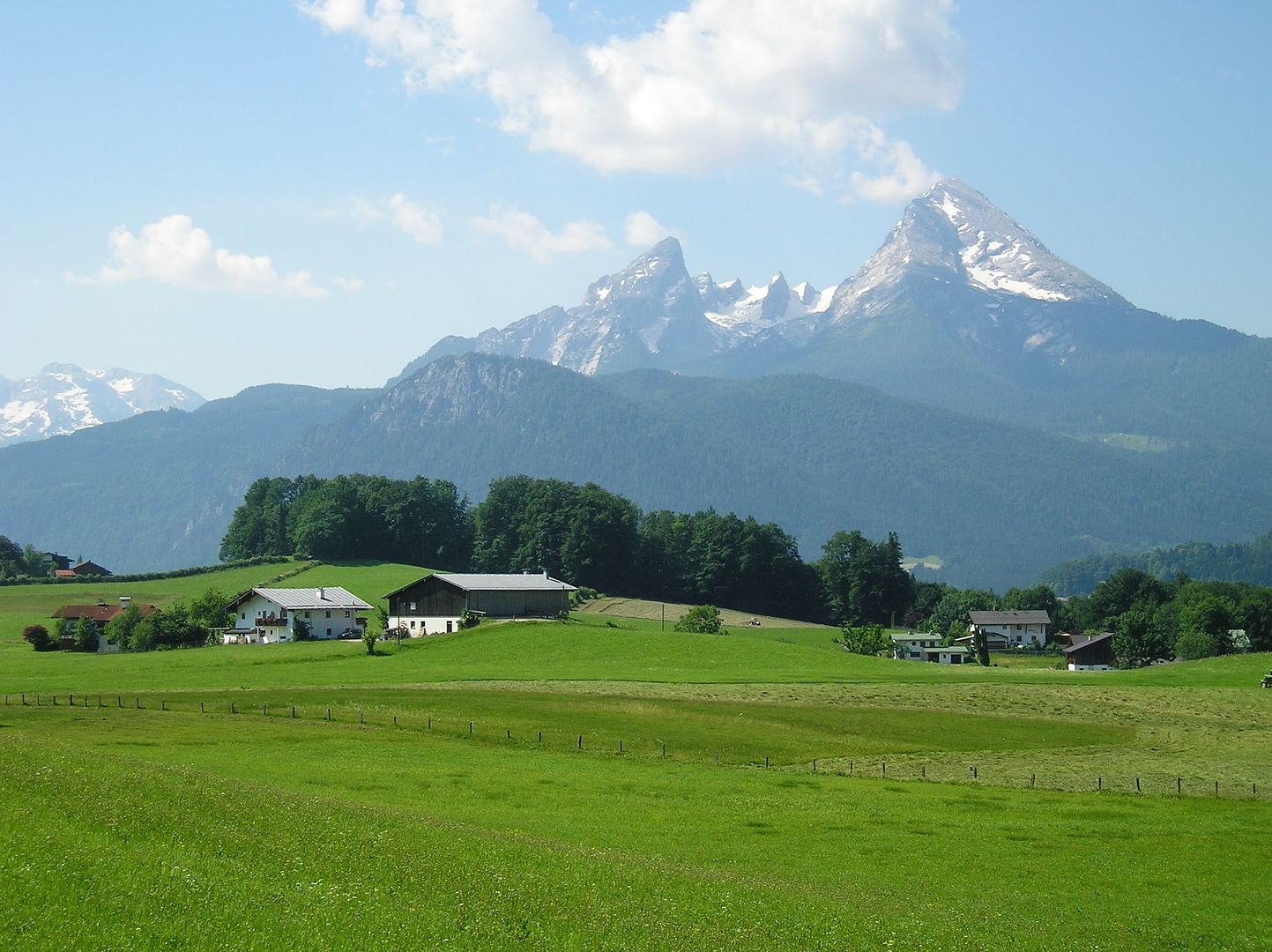
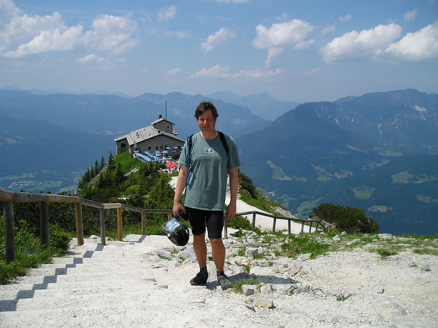
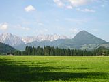
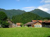
Sunday, June 22, 2008
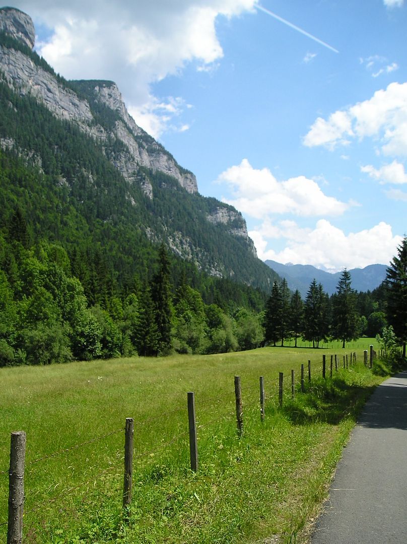
June 22
33 miles, 7.7 mph, 2430'´elevation gain
(Bad Reichenhall, Germany to Berchtesgaden & back)
View 2008-06-22a Bad Reichenhall to Berchtesgaden, Germany in a larger map
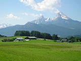
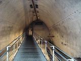
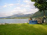
Highlights: beautiful ride to/from Berchtesgaden, visiting Obersalzberg & Eagle's Nest, swimming again, last night of camping, overnight thunder/lightning
()
()

()

()
Journal: to come
(Bad Reichenhall, Germany to Berchtesgaden & back)
View 2008-06-22a Bad Reichenhall to Berchtesgaden, Germany in a larger map
Highlights: beautiful ride to/from Berchtesgaden, visiting Obersalzberg & Eagle's Nest, swimming again, last night of camping, overnight thunder/lightning
()

()
()
()
Journal: to come
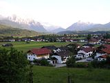
Saturday, June 21, 2008
June 21
57 miles, 8.9 mph, 2360'´elevation gain
(Walchsee, Austria to Bad Reichenhall, Germany)
View Larger Map
Highlights: first day with sunscreen in more than a week, all-around good day (weather, scenery, climbs, roads, swimming), reaching Bad Reichenhall
()
()
()
()
Journal: to come
(Walchsee, Austria to Bad Reichenhall, Germany)
View Larger Map
Highlights: first day with sunscreen in more than a week, all-around good day (weather, scenery, climbs, roads, swimming), reaching Bad Reichenhall

()
()
()
()
Journal: to come
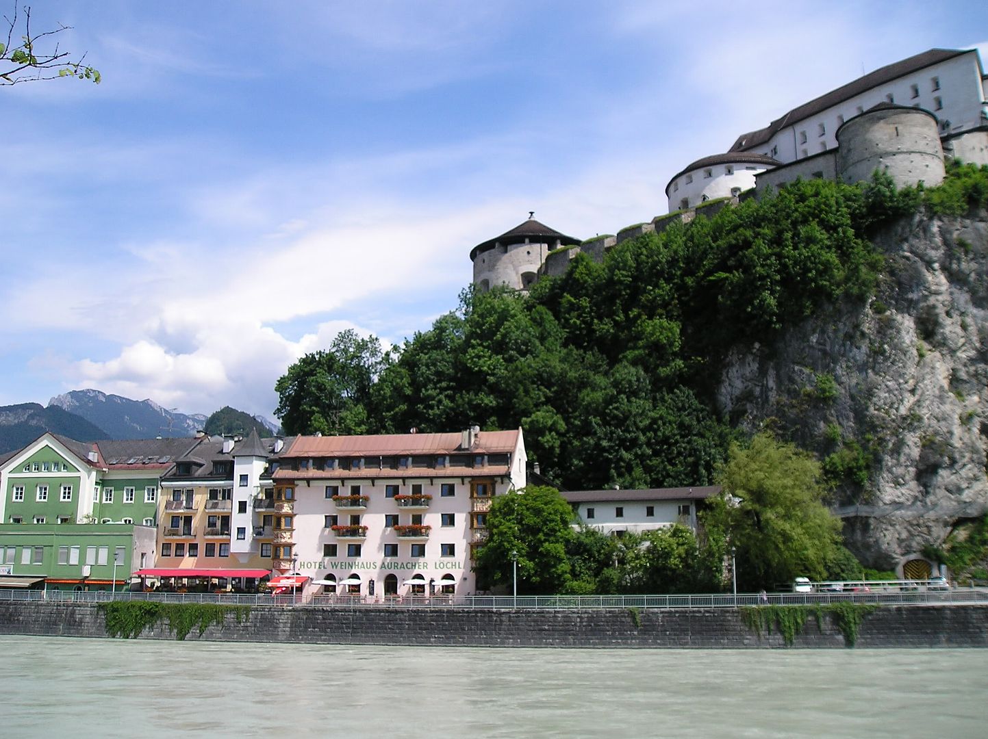
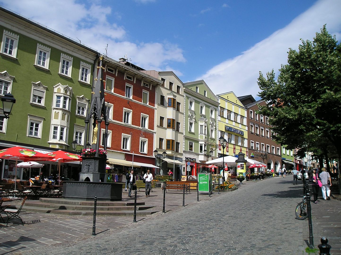
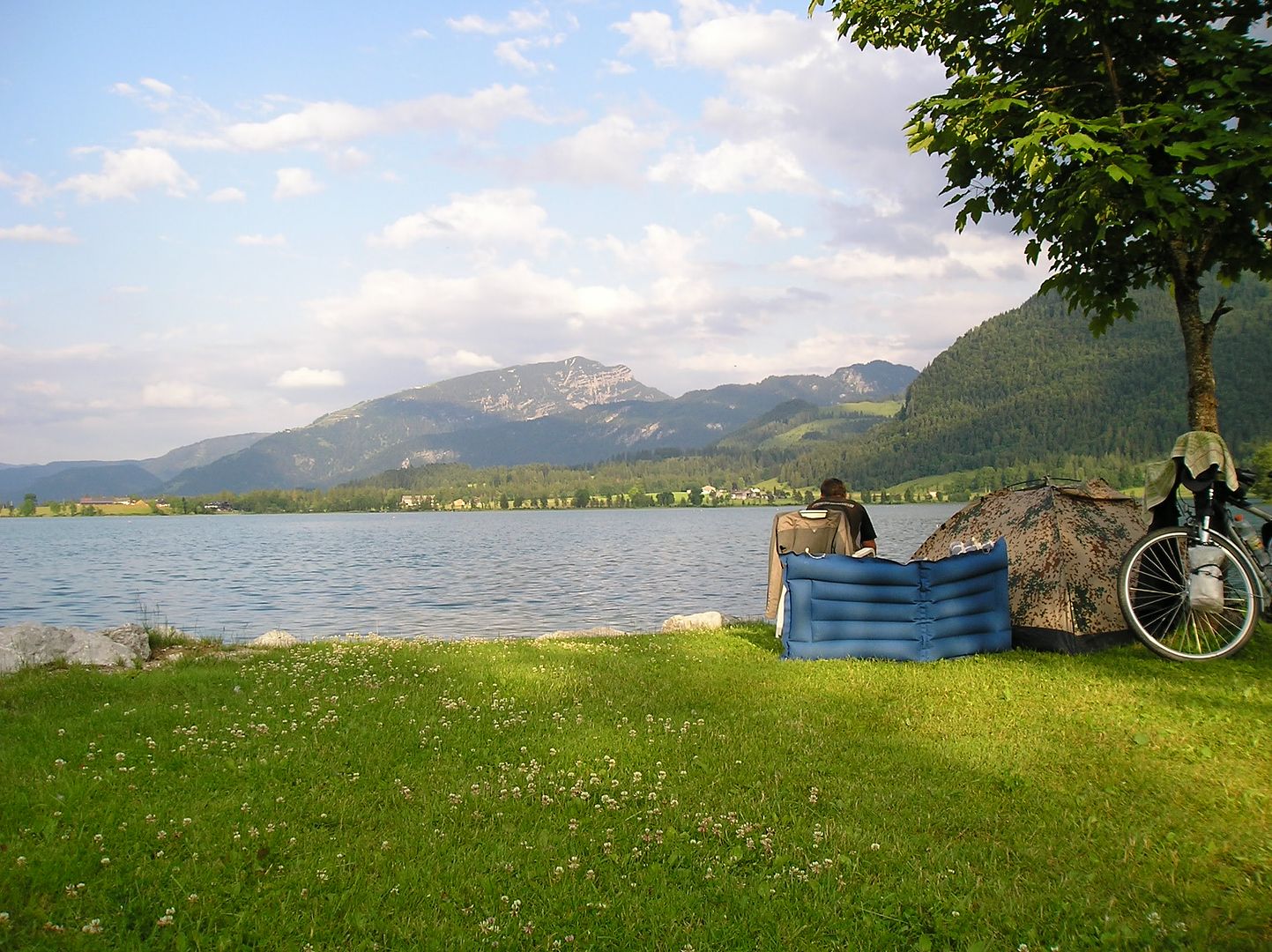
Friday, June 20, 2008
Can't Escape The Noise!
57 miles, 9.2 mph, 1580'´elevation gain
(Weer, Austria to Walchsee)
View Larger Map
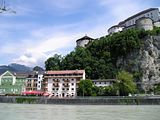
Highlights: riding near freeway/noise til late afternoon, walking tour of Kufstein, beautiful camping spot

()
()
()
()

()
()
Journal: to come
(Weer, Austria to Walchsee)
View Larger Map
Highlights: riding near freeway/noise til late afternoon, walking tour of Kufstein, beautiful camping spot
()
()

()
()
()
()
Journal: to come
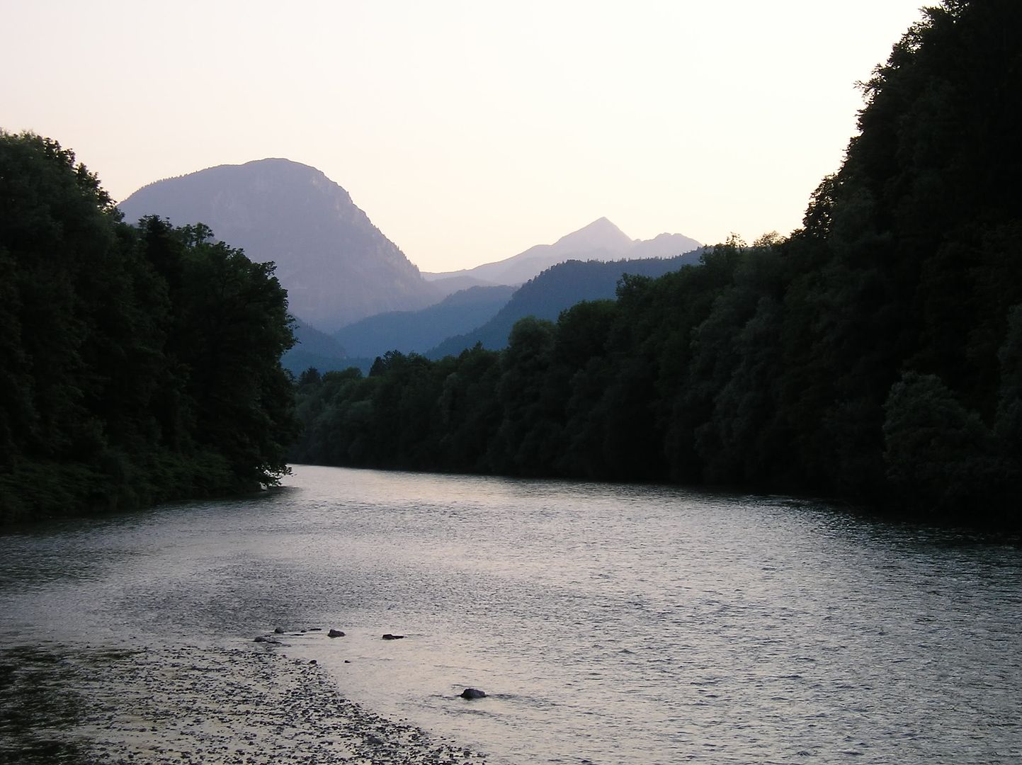
Thursday, June 19, 2008
Clean Clothes
32 miles, 7.1 mph, 1290' elevation gain
(Wallgau, Germany to Scharnitz, Austria by bike; to Innsbruck via train; to Weer by bike)
View 2008-06-19a Wallgau, Germany to Scharnitz, Austria in a larger map
View 2008-06-19b Innsbruck to Weer, Austria in a larger map
Highlights: good weather again, feeling refreshed, beautiful alpine scenery, highest point of 6-week bike trip (3200' elevation), train to Innsbruck, swimming pool break
()
()

()

()
()

()
()
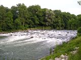
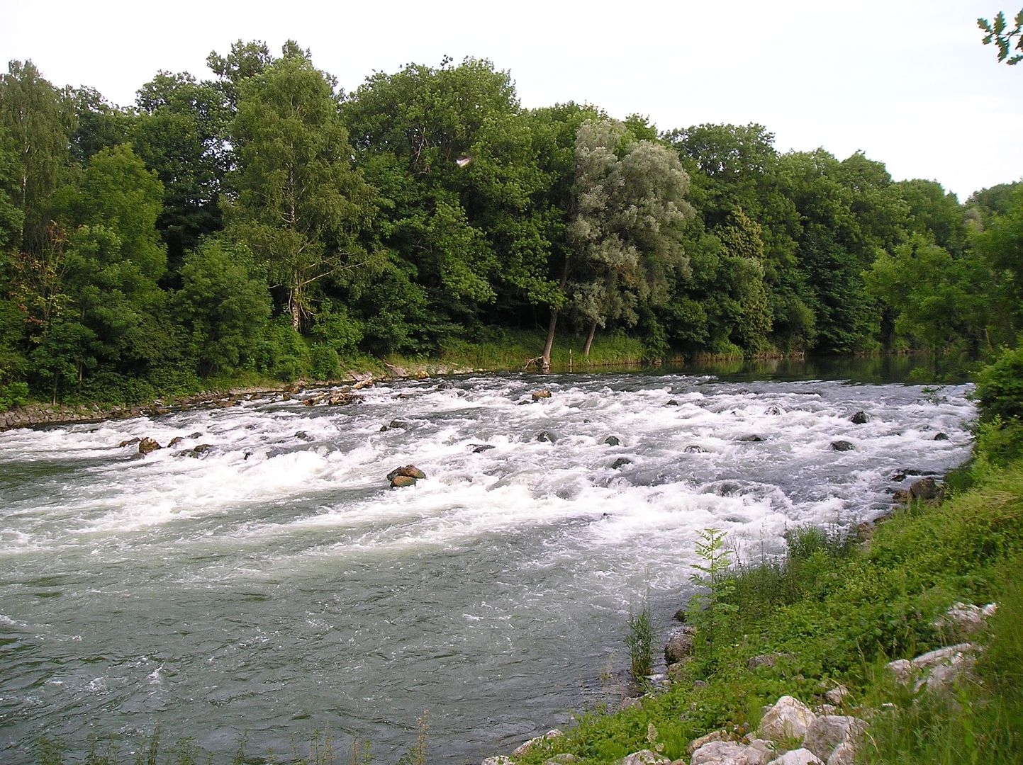
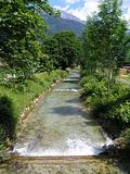
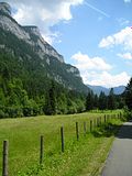
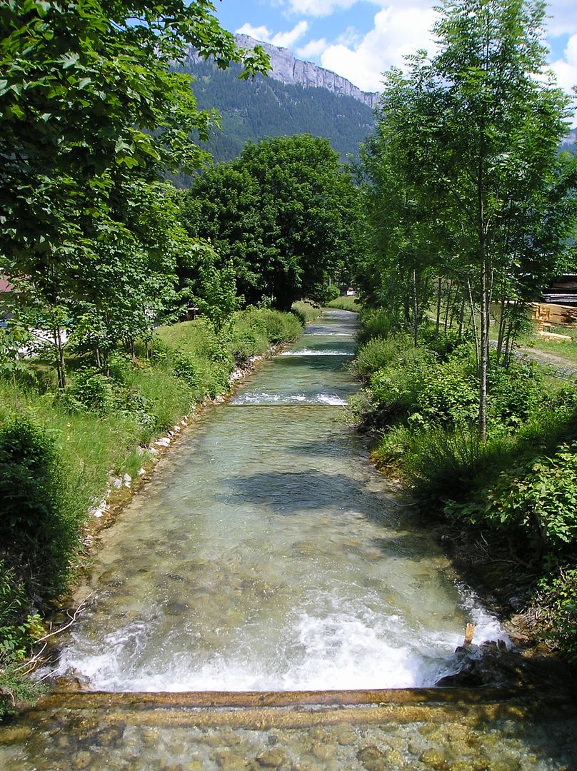
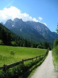
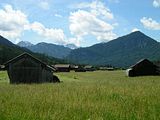
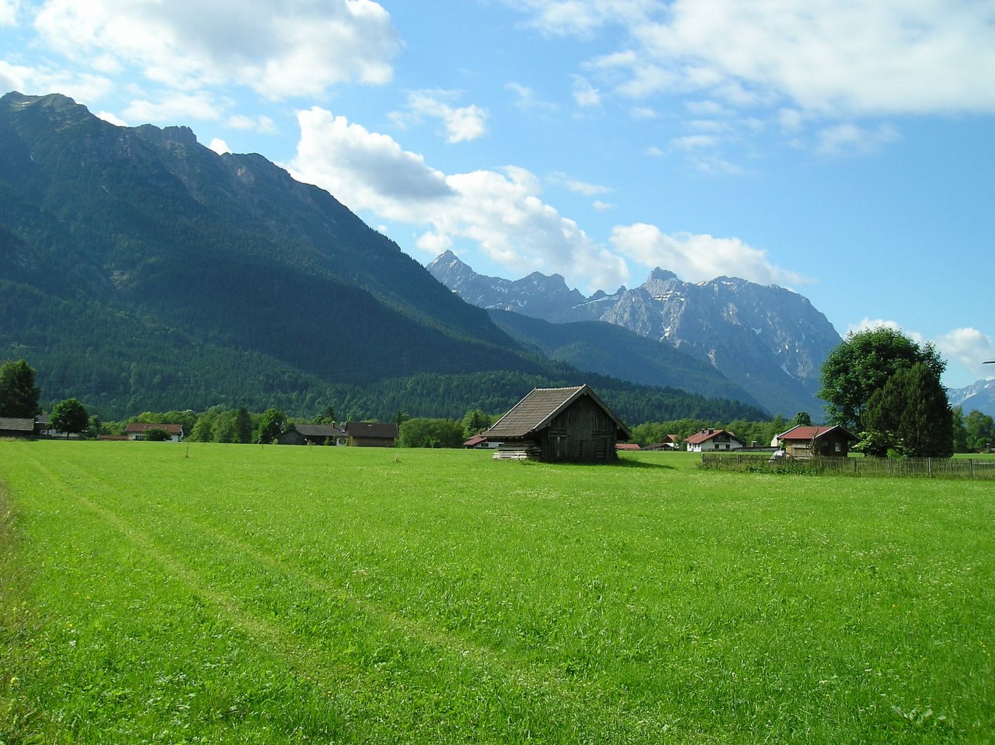
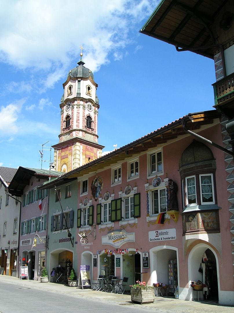
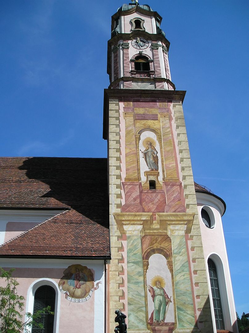
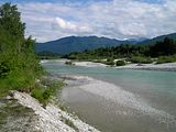
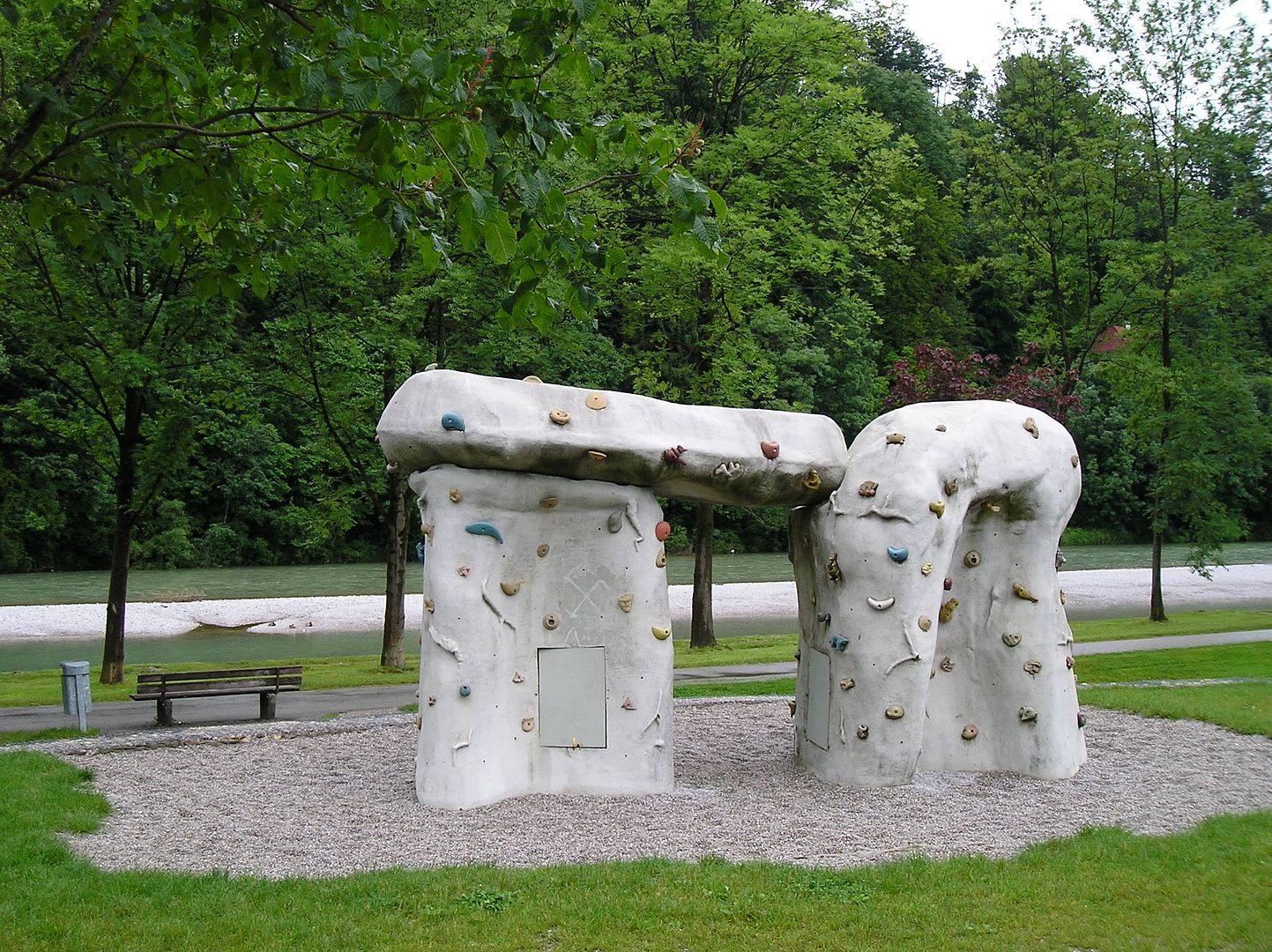
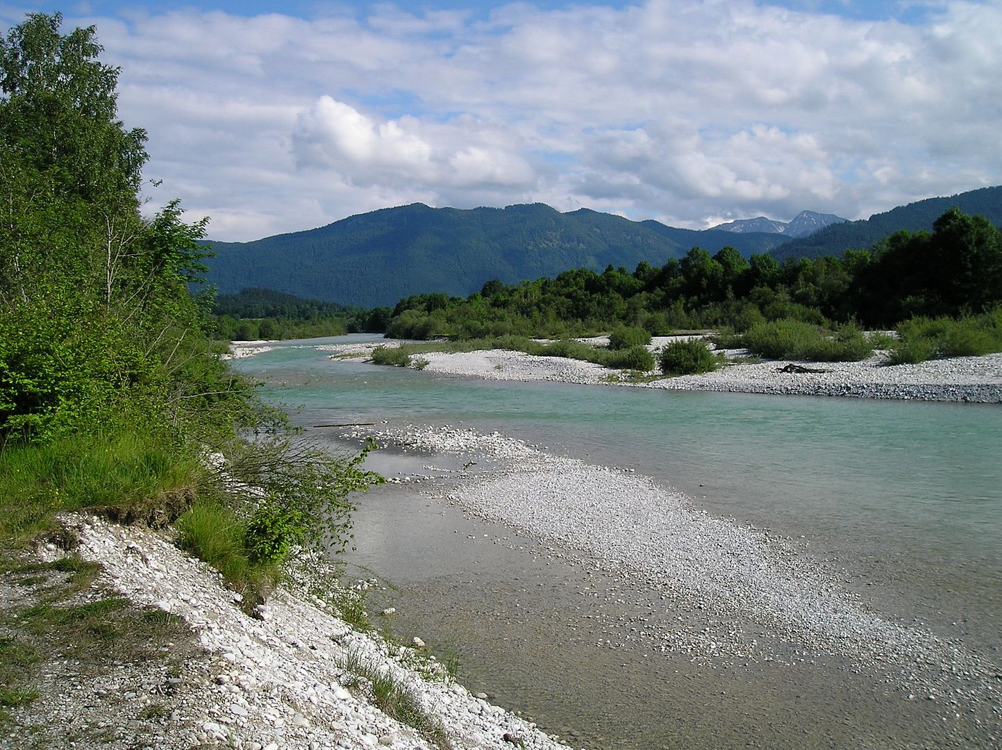
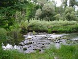
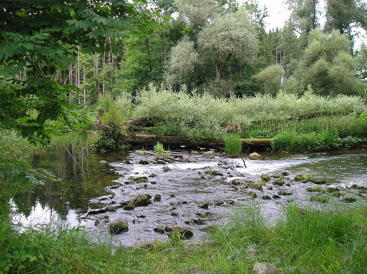
Journal: This morning I was surrounded by beautiful Bavarian alpine scenery as I gently climbed the remaining 300-400 feet in elevation to the Austrian border. At times the scenery was so spectacular it was hard not to have a smile on my face. I stopped at the picturesque town of Mittenwald along the way, then proceeded into Austria (for the 4th time on this trip). Upon reaching Scharnitz (just a few kilometers across the border) I was now finished with my ride along the entire River Isar from end to end. There is an optional 12 km route that goes to the actual source of the Isar, but since this river holds no particular affection for me I decided to pass. From Scharnitz to Innsbruck is only 20 km as the crow flies, but one must cross some impressive 7000'+ mountains that way. So I boarded the next train to Innsbruck and enjoyed the great views as we climbed over the pass (with the aid of tunnels) and descended into the valley towards Innsbruck.
My original plan was to take a day off today in Innsbruck. However, the delayed start yesterday morning kept me from reaching Innsbruck until afternoon today. That ended up being a good thing since the final round-robin match of the Eurocup 2008 soccer tournament was in Innsbruck last night, so accommodations may have been had to find or expensive. Also, for whatever reason, Innsbruck did not appeal to me upon arrival. Perhaps I have been to one too many nice European cities on this trip. It probably didn't help that I had no idea what to do or where to go in the city either. Or that the youth hostel I had planned on staying in doesn't open until summer (since when is June 19 not part of the summer season?). Or that the other hostels didn't allow check-in until 5 pm. Or that I could have "camped" at the Eurocup FanCamp for 15-25 Euros with a bunch of noisy soccer fans. So, after walking around the city center for an hour or so and resting at a riverside cafe for another hour, I reluctantly decided to move on. Mentally I had prepared myself for a day off in Innsbruck, but I wasn't thrilled with the overnight options and wanted to ride a few more kilometers anyways to give myself enough time to reach Berchtesgaden before the 23rd.
As I headed down the valley next to the River Inn my forward progress was hampered by strong headwinds. It was also quite noisy (due to the headwinds & nearby freeway traffic) so it wasn't anywhere near as enjoyable as this morning. What I really wanted was to find a place to do my laundry & check the internet. When I passed a local swimming pool I decided to take a break from the wind & heat. I did feel refreshed afterward, but decided to call it a day when I found a nearby campground with a washing machine. Happy to have clean clothes again!
(Wallgau, Germany to Scharnitz, Austria by bike; to Innsbruck via train; to Weer by bike)
View 2008-06-19a Wallgau, Germany to Scharnitz, Austria in a larger map
View 2008-06-19b Innsbruck to Weer, Austria in a larger map
Highlights: good weather again, feeling refreshed, beautiful alpine scenery, highest point of 6-week bike trip (3200' elevation), train to Innsbruck, swimming pool break
()

()
()
()

()

()

()
Journal: This morning I was surrounded by beautiful Bavarian alpine scenery as I gently climbed the remaining 300-400 feet in elevation to the Austrian border. At times the scenery was so spectacular it was hard not to have a smile on my face. I stopped at the picturesque town of Mittenwald along the way, then proceeded into Austria (for the 4th time on this trip). Upon reaching Scharnitz (just a few kilometers across the border) I was now finished with my ride along the entire River Isar from end to end. There is an optional 12 km route that goes to the actual source of the Isar, but since this river holds no particular affection for me I decided to pass. From Scharnitz to Innsbruck is only 20 km as the crow flies, but one must cross some impressive 7000'+ mountains that way. So I boarded the next train to Innsbruck and enjoyed the great views as we climbed over the pass (with the aid of tunnels) and descended into the valley towards Innsbruck.
My original plan was to take a day off today in Innsbruck. However, the delayed start yesterday morning kept me from reaching Innsbruck until afternoon today. That ended up being a good thing since the final round-robin match of the Eurocup 2008 soccer tournament was in Innsbruck last night, so accommodations may have been had to find or expensive. Also, for whatever reason, Innsbruck did not appeal to me upon arrival. Perhaps I have been to one too many nice European cities on this trip. It probably didn't help that I had no idea what to do or where to go in the city either. Or that the youth hostel I had planned on staying in doesn't open until summer (since when is June 19 not part of the summer season?). Or that the other hostels didn't allow check-in until 5 pm. Or that I could have "camped" at the Eurocup FanCamp for 15-25 Euros with a bunch of noisy soccer fans. So, after walking around the city center for an hour or so and resting at a riverside cafe for another hour, I reluctantly decided to move on. Mentally I had prepared myself for a day off in Innsbruck, but I wasn't thrilled with the overnight options and wanted to ride a few more kilometers anyways to give myself enough time to reach Berchtesgaden before the 23rd.
As I headed down the valley next to the River Inn my forward progress was hampered by strong headwinds. It was also quite noisy (due to the headwinds & nearby freeway traffic) so it wasn't anywhere near as enjoyable as this morning. What I really wanted was to find a place to do my laundry & check the internet. When I passed a local swimming pool I decided to take a break from the wind & heat. I did feel refreshed afterward, but decided to call it a day when I found a nearby campground with a washing machine. Happy to have clean clothes again!
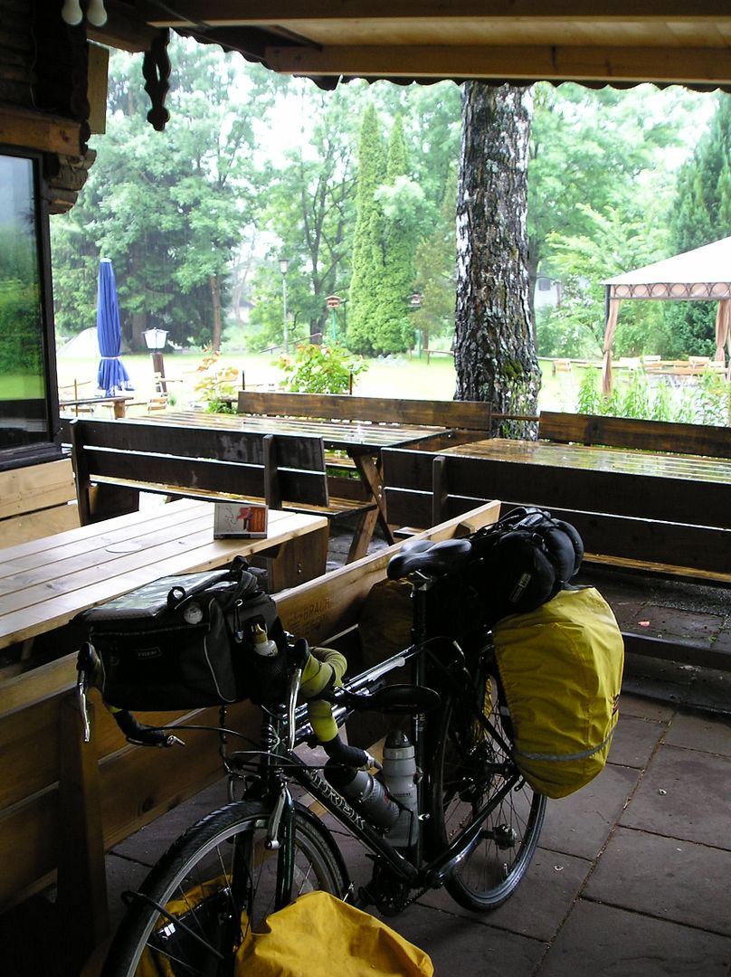
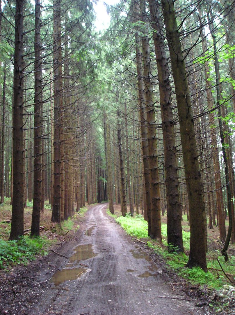
Wednesday, June 18, 2008
Surprise Rain
51 miles, 9.0 mph, 2450' elevation gain
(Wolfratshausen, Germany to Wallgau)
View Larger Map
Highlights: heavy morning rain, two-hour delayed start, forests & glacial river water in afternoon, pleasing mountain roads, tired & wet/cold by evening

()

()

()
()
()
()

()

()
()
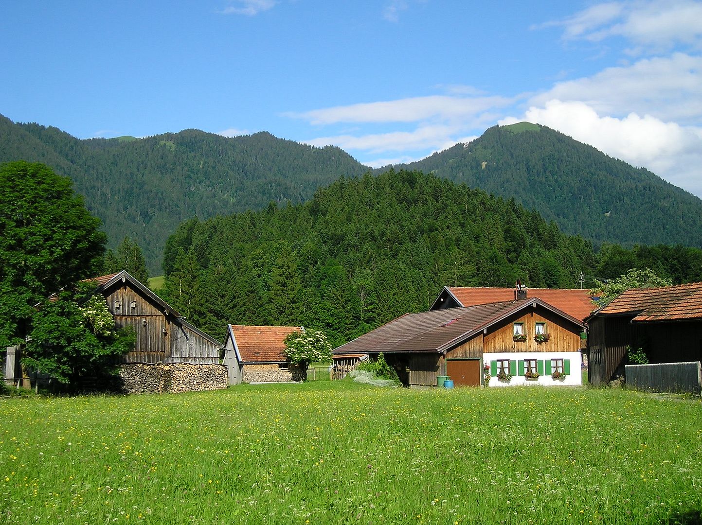
Journal: When I checked the weather two days ago, the rain was supposed to end yesterday. So I was a bit surprised when it started up at 5:30 this morning for a bit. Then again at 7:30 and 8:00. In between spurts I showered & packed up. Then, just before departure, it really started raining cats & dogs. Thankfully I was able to wait out the heavy rainstorm in an outdoor covered restaurant while reading a few chapters of "Appointment With Death." By the time the rain was finally over, I was two hours behind schedule, and after checking out Wolfratshausen & buying some food supplies, it wasn't until noon that I actually left town. Within an hour or so, it was drizzling again as I was riding along gravelly forest roads. Then I met a German couple who are walking from Munich to Venice, Italy and they told me the gloomy weather is supposed to continue through tomorrow. So when I got to the resort town of Bad Tolz at the edge of the mountains I contemplated calling it a day (after only 20 miles of riding) since I was somewhat cold & wet and not in the mood to stay that way all day long. However, when I checked the weather forecast it called for warmer temps & drier conditions beginning in the afternoon. Still unconvinced I walked around town and stopped inside a bakery for some goodies. When I walked out a few moments later the sun had reappeared & the temperature had suddenly changed from cold to hot. So, at 4 o'clock I decided to press on and see how far I could get.
The rest of the afternoon & evening went quite well. The sun stayed out and I had pleasant mountain scenery to enjoy. The farmland was replaced by forest land, and the river was now a cloudy green glacial melt. I had been dreading a 22 km stretch of road with "heavy" & "moderate" traffic, but it was not bad at all (light traffic, wide lanes & no trucks on the busy road). Still the ride was not stress free as I was slightly worried about getting someplace to stay by nightfall. I was not going to make it to Innsbruck (my original plan) due to the delayed morning start and did not want to camp again in the chilly weather (since I don't have any clean dry clothes left). By the time I reached the Wallgau valley at 8 pm I was tired, wet & cold. Fortunately this is a vacation area and there were TONS of accommodations to choose from. I selected a small guesthouse at a reasonable price (28 Euros, including breakfast) and promptly headed for a long warm shower.
(Wolfratshausen, Germany to Wallgau)
View Larger Map
Highlights: heavy morning rain, two-hour delayed start, forests & glacial river water in afternoon, pleasing mountain roads, tired & wet/cold by evening
()
()
()
()
()
()
()

()
()
Journal: When I checked the weather two days ago, the rain was supposed to end yesterday. So I was a bit surprised when it started up at 5:30 this morning for a bit. Then again at 7:30 and 8:00. In between spurts I showered & packed up. Then, just before departure, it really started raining cats & dogs. Thankfully I was able to wait out the heavy rainstorm in an outdoor covered restaurant while reading a few chapters of "Appointment With Death." By the time the rain was finally over, I was two hours behind schedule, and after checking out Wolfratshausen & buying some food supplies, it wasn't until noon that I actually left town. Within an hour or so, it was drizzling again as I was riding along gravelly forest roads. Then I met a German couple who are walking from Munich to Venice, Italy and they told me the gloomy weather is supposed to continue through tomorrow. So when I got to the resort town of Bad Tolz at the edge of the mountains I contemplated calling it a day (after only 20 miles of riding) since I was somewhat cold & wet and not in the mood to stay that way all day long. However, when I checked the weather forecast it called for warmer temps & drier conditions beginning in the afternoon. Still unconvinced I walked around town and stopped inside a bakery for some goodies. When I walked out a few moments later the sun had reappeared & the temperature had suddenly changed from cold to hot. So, at 4 o'clock I decided to press on and see how far I could get.
The rest of the afternoon & evening went quite well. The sun stayed out and I had pleasant mountain scenery to enjoy. The farmland was replaced by forest land, and the river was now a cloudy green glacial melt. I had been dreading a 22 km stretch of road with "heavy" & "moderate" traffic, but it was not bad at all (light traffic, wide lanes & no trucks on the busy road). Still the ride was not stress free as I was slightly worried about getting someplace to stay by nightfall. I was not going to make it to Innsbruck (my original plan) due to the delayed morning start and did not want to camp again in the chilly weather (since I don't have any clean dry clothes left). By the time I reached the Wallgau valley at 8 pm I was tired, wet & cold. Fortunately this is a vacation area and there were TONS of accommodations to choose from. I selected a small guesthouse at a reasonable price (28 Euros, including breakfast) and promptly headed for a long warm shower.
Tuesday, June 17, 2008
Gloomy Boredom
69 miles, 10.2 mph, 2020' elevation gain
(Dingolfing, Germany to Freising by bike; to Deisenhofen by S-Bahn train; to Wolfratshausen by bike)
View 2008-06-17a Dingolfing to Freising, Germany in a larger map
View 2008-06-17b Deisenhofen to Wolfratshausen, Germany in a larger map
Highlights: gloomy day 'til the evening, high river levels, tired after train ride across Munich, ended up where I wanted to be
()
()

()

()
()

()
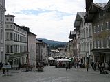
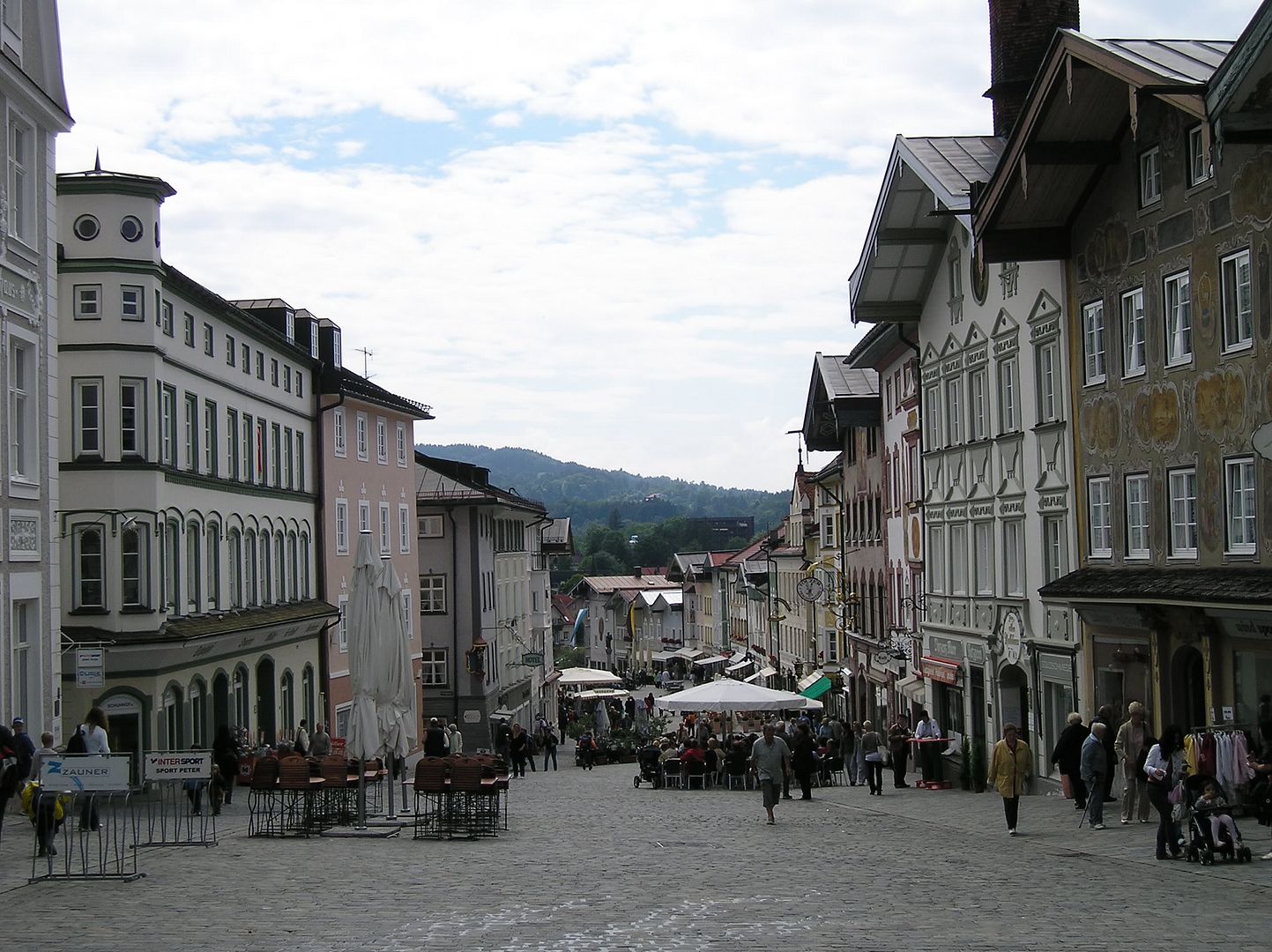
Journal: Woke up this morning to a rather gloomy looking overcast day. The sky was gray and the forecast called for rain (70% chance). Since I was not looking forward to today's ride (pretty boring & wet) I took my time checking out of the hotel (and made sure to take full advantage of the all-you-can-eat breakfast before doing so). Started pedaling shortly after 10 am and the remainder of the morning was just as predicted...boring (mostly gravelly roads along the river's dike, with limited forest views). My goal was to reach the northern Munich suburb of Freising (where I could catch an S-Bahn train to the southern side), but it seemed to take forever to get there. The afternoon was slightly more interesting as I stopped for a hot chocolate & pastry break in the bustling, attractive old town of Landshut before riding along rural roads for an hour or so. Then a return to the flat gravel river path, which bored me enough I decided to take a hillier (but more interesting) approach into Freising.
By the time I reached the train station in town & purchased my rail ticket it was almost 5:30. Wasn't sure how long it would take to reach the southern side of Munich, but I did want to end up someplace where I could camp. As I was riding the S-Bahn (commuter rail) into Munich & out the other side, I realized I was actually quite tired & not in the mood for much more riding today. When I got off the S5 train in Disenhofen it was 7 pm, so I decided I would simply ride back one long stop on the S20 train to the Munich campground I stayed at a month ago. However, unlike all the other S-Bahn lines which seem to run every 10-20 minutes, the S20 only operates hourly & I would have to wait 50 minutes for the next one. Instead of waiting I reluctantly decided to ride southwest towards the next big town on the River Isar. Depending on hills & my energy level, I figured it would take me one to two hours. Of the two bike maps I had, only one of them showed a campground in town so I was chancing it. On the upside, the sun had come out again and the terrain was mostly flat or downhill (descending into the river valley). I reached Wolfratshausen around 8:20 and happily discovered there was in fact a campground in town. After eating some goulash soup & pomme frites for dinner, I watched Italy beat France in Eurocup soccer, then went to sleep. Tomorrow I will ride as far upriver as I can before catching a short train ride over (or through?) the mountains to Innsbruck, Austria. The weather is supposed to be much better, so I am looking forward to the ride despite the climbing.
(Dingolfing, Germany to Freising by bike; to Deisenhofen by S-Bahn train; to Wolfratshausen by bike)
View 2008-06-17a Dingolfing to Freising, Germany in a larger map
View 2008-06-17b Deisenhofen to Wolfratshausen, Germany in a larger map
Highlights: gloomy day 'til the evening, high river levels, tired after train ride across Munich, ended up where I wanted to be

()

()

()
()
()
()
Journal: Woke up this morning to a rather gloomy looking overcast day. The sky was gray and the forecast called for rain (70% chance). Since I was not looking forward to today's ride (pretty boring & wet) I took my time checking out of the hotel (and made sure to take full advantage of the all-you-can-eat breakfast before doing so). Started pedaling shortly after 10 am and the remainder of the morning was just as predicted...boring (mostly gravelly roads along the river's dike, with limited forest views). My goal was to reach the northern Munich suburb of Freising (where I could catch an S-Bahn train to the southern side), but it seemed to take forever to get there. The afternoon was slightly more interesting as I stopped for a hot chocolate & pastry break in the bustling, attractive old town of Landshut before riding along rural roads for an hour or so. Then a return to the flat gravel river path, which bored me enough I decided to take a hillier (but more interesting) approach into Freising.
By the time I reached the train station in town & purchased my rail ticket it was almost 5:30. Wasn't sure how long it would take to reach the southern side of Munich, but I did want to end up someplace where I could camp. As I was riding the S-Bahn (commuter rail) into Munich & out the other side, I realized I was actually quite tired & not in the mood for much more riding today. When I got off the S5 train in Disenhofen it was 7 pm, so I decided I would simply ride back one long stop on the S20 train to the Munich campground I stayed at a month ago. However, unlike all the other S-Bahn lines which seem to run every 10-20 minutes, the S20 only operates hourly & I would have to wait 50 minutes for the next one. Instead of waiting I reluctantly decided to ride southwest towards the next big town on the River Isar. Depending on hills & my energy level, I figured it would take me one to two hours. Of the two bike maps I had, only one of them showed a campground in town so I was chancing it. On the upside, the sun had come out again and the terrain was mostly flat or downhill (descending into the river valley). I reached Wolfratshausen around 8:20 and happily discovered there was in fact a campground in town. After eating some goulash soup & pomme frites for dinner, I watched Italy beat France in Eurocup soccer, then went to sleep. Tomorrow I will ride as far upriver as I can before catching a short train ride over (or through?) the mountains to Innsbruck, Austria. The weather is supposed to be much better, so I am looking forward to the ride despite the climbing.
Monday, June 16, 2008
Time To Splurge
61 miles, 9.8 mph, 1810' elevation gain
(Kaiser, Austria to Linz on bike; to Plattling, Germany by train; to Dingolfing on bike)
View 2008-06-16a Kaiser, Austria to Linz in a larger map
View 2008-06-16b Plattling, Germany to Dingolfing in a larger map
Highlights: overnight rain, mostly cool & overcast, completion of the Danube River bike route, train ride to River Isar, inside accommodations
()

()
()
Journal: When I woke up this morning I wasn't sure what I would do when I reached Linz (about 40 km away) to complete the Danube River portion of my bike ride. The only thing I knew was I would be taking a train somewhere. Option #1 was taking the train to Gmunden (where I was about a month ago) on the edge of the Austrian Alps & riding back to Salzburg (& perhaps farther). Option #2 was training it back to Passau, Germany (where I was yesterday) and riding the River Inn towards Innsbruck, Austria. And Option #3 was returning to Plattling, Germany (where I was two days ago) & riding the River Isar up to Munich & Innsbruck. Only when I reached Linz around noon did I make up my mind. I scrapped Option #1 since the weather is supposed to be rather gloomy for the next two days, and what's the point of riding in the mountains if you can't see them? Also, the Eurocup 2008 football tournament is taking place in Salzburg (& other venues) and I didn't want to worry about finding accommodations there. I scrapped Option #2 since I know nothing about the River Inn (except for the 30 km stretch I rode a month ago), and I don't have the necessary maps. So option #3 is...ride up the river Isar to its source near the Austrian border, then take a short train ride to Innsbruck before heading downriver along the River Inn towards Salzburg. Hopefully I will have enough time to visit Berchtesgaden (which I failed to reach in May) before taking the train back to Munich to catch my flight on June 25.
As far as riding goes, there was nothing terribly inspiring today. Mostly river riding (first the Danube, then the Isar) but without too many scenic spots. By the time I reached the town of Dingolfing (home of BMW's large automobile plant) around 7 pm it looked like rain again. Since I have camped five nights in a row (including two nights in the rain) I decided to splurge and get a hotel room. As I was looking at the town's map & trying to locate the nearest hotel, an off-duty police officer saw me & kindly assisted me in finding a good place to stay. He even rode his bike with me to show me how to get there.
(Kaiser, Austria to Linz on bike; to Plattling, Germany by train; to Dingolfing on bike)
View 2008-06-16a Kaiser, Austria to Linz in a larger map
View 2008-06-16b Plattling, Germany to Dingolfing in a larger map
Highlights: overnight rain, mostly cool & overcast, completion of the Danube River bike route, train ride to River Isar, inside accommodations

()

()

()
Journal: When I woke up this morning I wasn't sure what I would do when I reached Linz (about 40 km away) to complete the Danube River portion of my bike ride. The only thing I knew was I would be taking a train somewhere. Option #1 was taking the train to Gmunden (where I was about a month ago) on the edge of the Austrian Alps & riding back to Salzburg (& perhaps farther). Option #2 was training it back to Passau, Germany (where I was yesterday) and riding the River Inn towards Innsbruck, Austria. And Option #3 was returning to Plattling, Germany (where I was two days ago) & riding the River Isar up to Munich & Innsbruck. Only when I reached Linz around noon did I make up my mind. I scrapped Option #1 since the weather is supposed to be rather gloomy for the next two days, and what's the point of riding in the mountains if you can't see them? Also, the Eurocup 2008 football tournament is taking place in Salzburg (& other venues) and I didn't want to worry about finding accommodations there. I scrapped Option #2 since I know nothing about the River Inn (except for the 30 km stretch I rode a month ago), and I don't have the necessary maps. So option #3 is...ride up the river Isar to its source near the Austrian border, then take a short train ride to Innsbruck before heading downriver along the River Inn towards Salzburg. Hopefully I will have enough time to visit Berchtesgaden (which I failed to reach in May) before taking the train back to Munich to catch my flight on June 25.
As far as riding goes, there was nothing terribly inspiring today. Mostly river riding (first the Danube, then the Isar) but without too many scenic spots. By the time I reached the town of Dingolfing (home of BMW's large automobile plant) around 7 pm it looked like rain again. Since I have camped five nights in a row (including two nights in the rain) I decided to splurge and get a hotel room. As I was looking at the town's map & trying to locate the nearest hotel, an off-duty police officer saw me & kindly assisted me in finding a good place to stay. He even rode his bike with me to show me how to get there.
Sunday, June 15, 2008
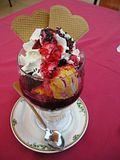
$10 Ice Cream
66 miles, 10.9 mph, 1090' elevation gain
(Nesslbach, Germany to Kaiser, Austria)
View Larger Map
Highlights: last full day on the Danube, good weather, no wind, no hills, riding the S-curve at Schlogen, eating a $10 ice cream, outracing a cruise ship for 20 km
()

()
()

()
()

()

()
()

()

()
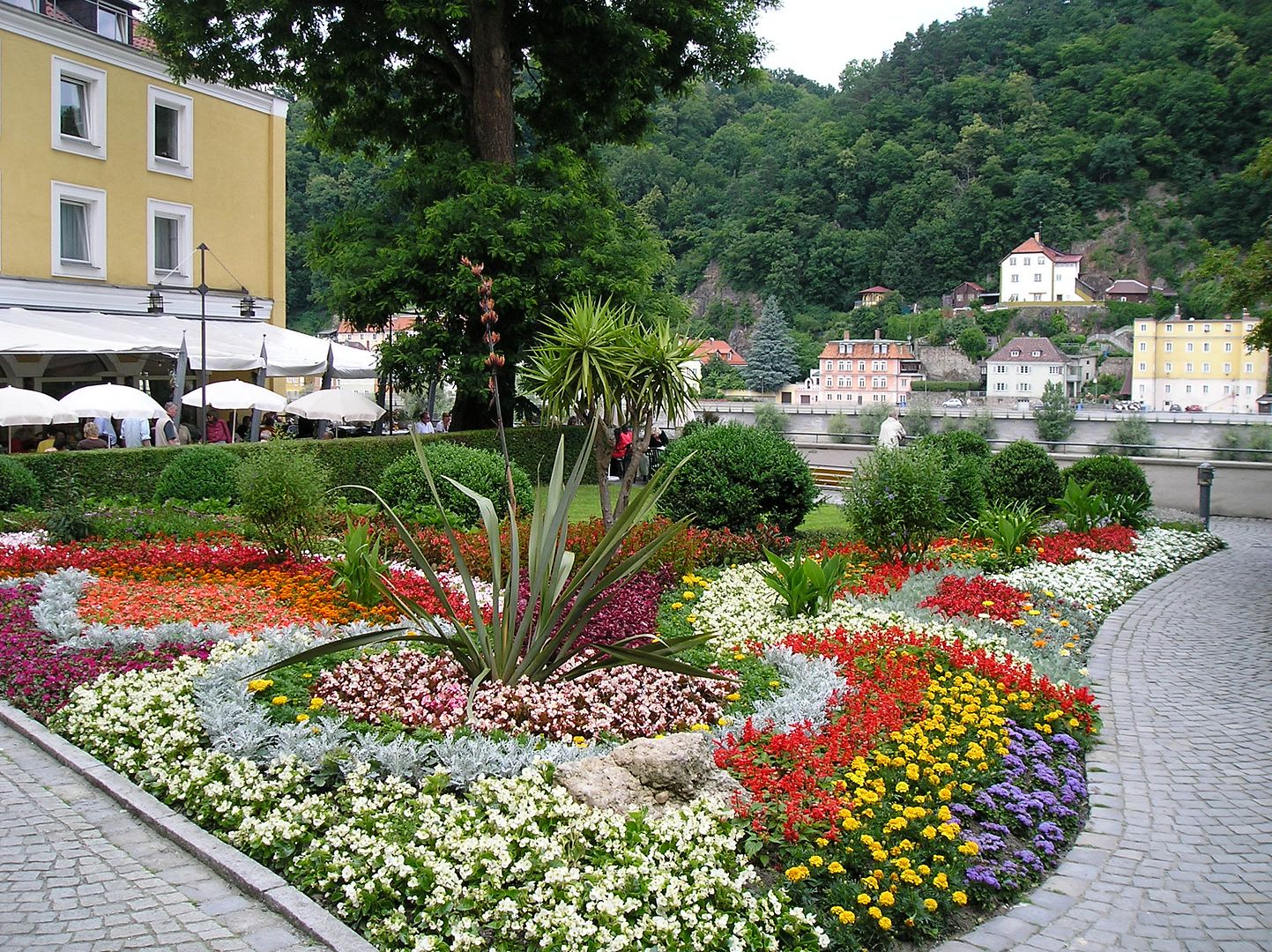
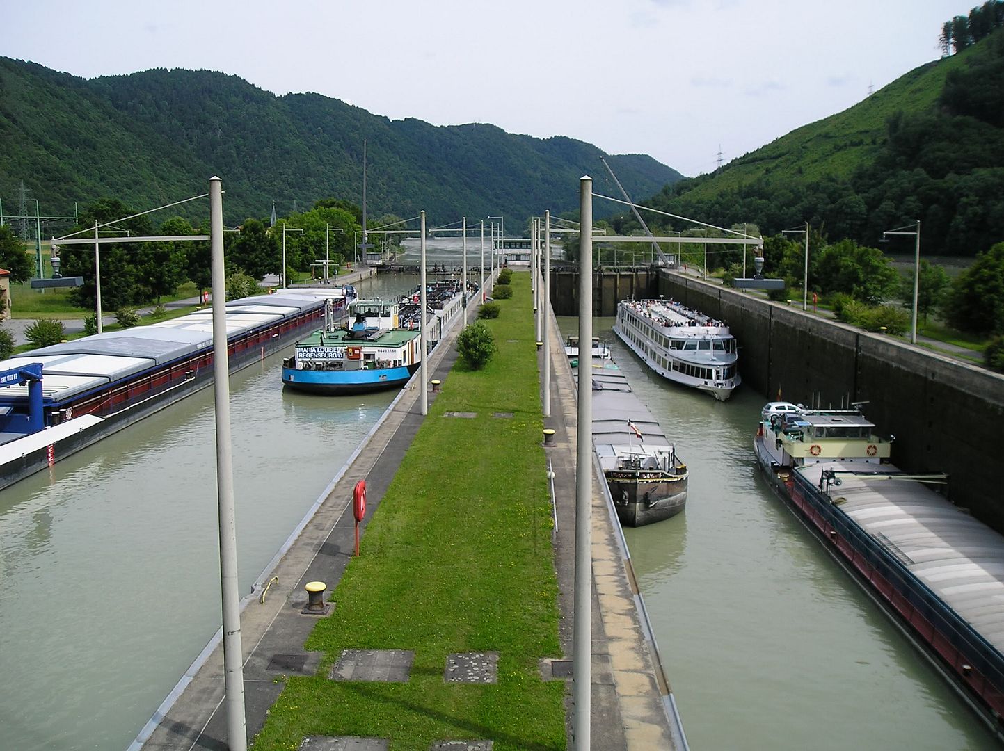
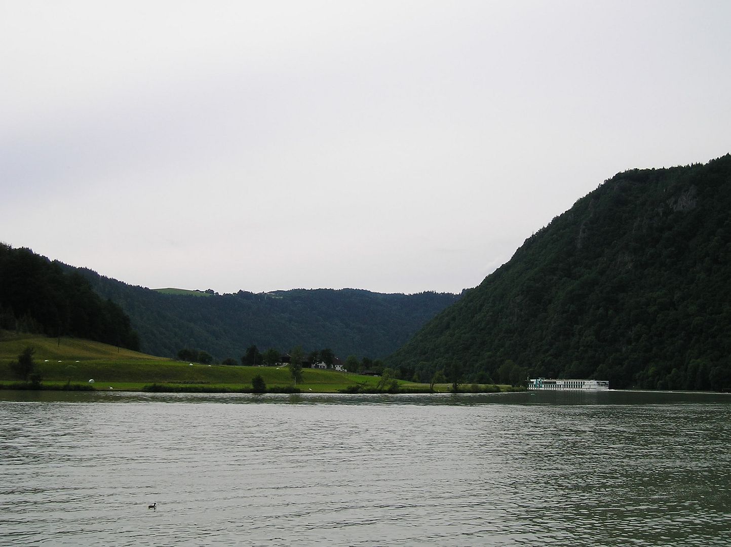
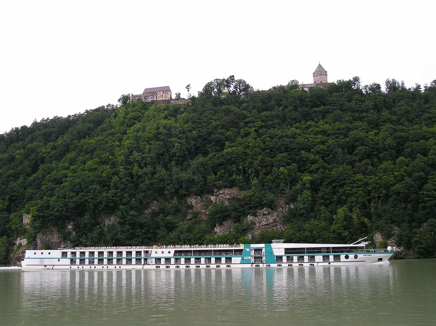
Journal: Woke up to a beautiful day (70 degrees & blue skies) for riding. Since I was riding without maps to Passau I asked for directions early on to get a sense of the riding conditions (in particular, which bank of the Danube was best to ride). Then, after reaching the scenic town of Vilshofen, I realized that I did indeed have some maps (although not the greatest) to get me to Passau. So I pulled them out and made it no problem to Passau (a wonderful, must-see city) for a relaxing lunch. I also rode past the second campground I was considering last night (in the small town of Irring, not Eering). It was 17 miles downriver from where I actually camped (a 1 hour, 40-minute ride) so I guess I could have made it here yesterday by nightfall, but it would have been stressful since I didn't know exactly where it was (or if it was even open).
After leaving Passau, I rode the left side of the river on good bike paths & pleasant local roads. Lots of cyclists were out riding, along with quite a few barges & pleasure craft on the river. At one point I clocked the barge speed at 14 mph going downstream, about the same speed I can ride on a flat surface going at 80%-90% effort. When it reaches the small Austrian resort town of Schlogen, the Danube makes an unusual 180 degree U-turn for a short distance as it confronts an impenetrable granite ridge, then loops back after finding a different route downstream. The bike path ends on the left bank in this area, so taking a bike ferry across the river was necessary here. For some strange reason, there are three different bike ferries competing here within a 4-km stretch of the S-curve. I chose the first one, which enabled me to take an expensive ice cream break before continuing. The final 20 km were quite exhilarating as I decided to race against a downriver cruise ship. It was a good challenge since the ship was traveling 14-16 mph (without stopping, of course). In the end, I declared myself the winner when I reached my eventual campground destination slightly ahead of the pleasure craft.
(Nesslbach, Germany to Kaiser, Austria)
View Larger Map
Highlights: last full day on the Danube, good weather, no wind, no hills, riding the S-curve at Schlogen, eating a $10 ice cream, outracing a cruise ship for 20 km
()
()

()
()

()
()
()

()
()
()
Journal: Woke up to a beautiful day (70 degrees & blue skies) for riding. Since I was riding without maps to Passau I asked for directions early on to get a sense of the riding conditions (in particular, which bank of the Danube was best to ride). Then, after reaching the scenic town of Vilshofen, I realized that I did indeed have some maps (although not the greatest) to get me to Passau. So I pulled them out and made it no problem to Passau (a wonderful, must-see city) for a relaxing lunch. I also rode past the second campground I was considering last night (in the small town of Irring, not Eering). It was 17 miles downriver from where I actually camped (a 1 hour, 40-minute ride) so I guess I could have made it here yesterday by nightfall, but it would have been stressful since I didn't know exactly where it was (or if it was even open).
After leaving Passau, I rode the left side of the river on good bike paths & pleasant local roads. Lots of cyclists were out riding, along with quite a few barges & pleasure craft on the river. At one point I clocked the barge speed at 14 mph going downstream, about the same speed I can ride on a flat surface going at 80%-90% effort. When it reaches the small Austrian resort town of Schlogen, the Danube makes an unusual 180 degree U-turn for a short distance as it confronts an impenetrable granite ridge, then loops back after finding a different route downstream. The bike path ends on the left bank in this area, so taking a bike ferry across the river was necessary here. For some strange reason, there are three different bike ferries competing here within a 4-km stretch of the S-curve. I chose the first one, which enabled me to take an expensive ice cream break before continuing. The final 20 km were quite exhilarating as I decided to race against a downriver cruise ship. It was a good challenge since the ship was traveling 14-16 mph (without stopping, of course). In the end, I declared myself the winner when I reached my eventual campground destination slightly ahead of the pleasure craft.
Subscribe to:
Posts (Atom)
